|
Abandoned Rails
<
Main Page
Virginian Railway -
Signals
|
As
most all railroads did in their early years of
operation, the Virginian Railway utilized semaphore signals
to govern train movements. As technology
evolved, the company began upgrading it's
infrastructure with searchlight style signals
manufactured by the General Railway Signal Company (GRS).
This page will examine these GRS searchlight
signals. It is important to note that not all
of the Virginian Railway was signaled. In 1946 signals were installed on the mainline
between Sewells
Point and Algren, where the Virginian crossed the
Seaboard Air Line at grade. Signals were also
installed on the western portion of the railroad
between Princeton and Deepwater in the early 1940's. Additional
locations that were signaled included Walnut Avenue Tower in Roanoke
and Jarratt, VA, both locations where the Virginian
crossed other railroads at grade. After the 1959 merger
with the N&W, signals were installed between Abilene and Princeton,
primarily in the form of the N&W's trademark color
position light signals.
In 1988 all of the signals between Maben (V381.8)
and Deepwater (V435) were deactivated by Norfolk
Southern.
Today the
number of original Virginian Railway
GRS searchlight signals that remain in service is
estimated to be
less than 25. A heavy concentration of those
remain in the Tidewater area of Virginia.
I would like to thank Aubrey Wiley,
Chuck Rippel, Bill Whitbeck, and Samuel Phillips for
their contributions to this page.
If you have
any photos or information you'd like to contribute, please
contact me at
jl.hawkins@comcast.net.
|
|
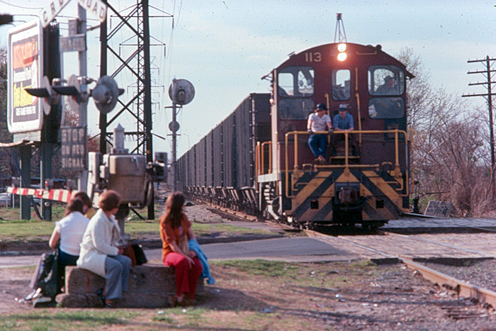
Granby Street (A5.5)
Not far outside Sewells Point was
the neighborhood of Wards Corner. This
westbound Norfolk & Portsmouth Beltline job has a
cut of coal hoppers in tow as it knocks down the
intermediate signal at Granby Street. The
women in the foreground have hunkered down for what
will likely be a lengthy wait until they are able to
cross the tracks.
The large concrete foundation they are sitting on
was the base for the crossing watchman's tower which
was manned around the clock.
Photo by Bill Whitbeck
(April 1978) |
|
Little Creek Road (A5.4)
The other grade crossing in Wards
Corner is Little Creek Road. A westbound
transfer job is seen passing the signal once located
here. The box on which the signal is mounted
still remains at this location.
Photo by Bill Whitbeck
(April 1980) |
|
Tidewater Drive (A3.8)
The intermediate signal in the right
of the photo stood along the eastbound mainline just
below the Tidewater Drive overpass. Passing
the signal is a Norfolk & Portsmouth Beltline
transfer job with a cut of empty grain cars enroute
from Sewells Point to N&W's Portlock Yard.
Barely discernable in the distance is another
intermediate searchlight signal for the westbound
main track.
Photo by Bill Whitbeck
(October 1977) |
|
Chesapeake Boulevard (A2.3)
Adjacent to the Chesapeake Boulevard
grade crossing in Norfolk is the only remaining
intermediate searchlight signal in the Tidewater
area. This installation serves as the distant
signal to Coleman Place for the westbound main
track.
Photo by Jeff Hawkins
(March 15, 2003) |
|
Coleman Place (A1.5)
Looking west towards the diamond at
Coleman Place.
Photo by Jeff Hawkins
(March 15, 2003) |
|
Coleman Place (A1.4)
A typical two head GRS searchlight
signal stands guard over the eastbound mainline at
Coleman Place in Norfolk. As was typical on
the double track segment in Norfolk, a dwarf signals
governs the opposing main track. Note the
multiple Virginian code line poles that were still
standing nearly 40 years after the N&W merger. To
learn more about Coleman Place, click
here.
Photo by Bill Whitbeck
(November 6, 1999) |
|
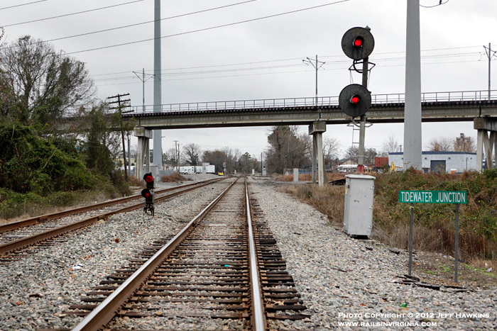
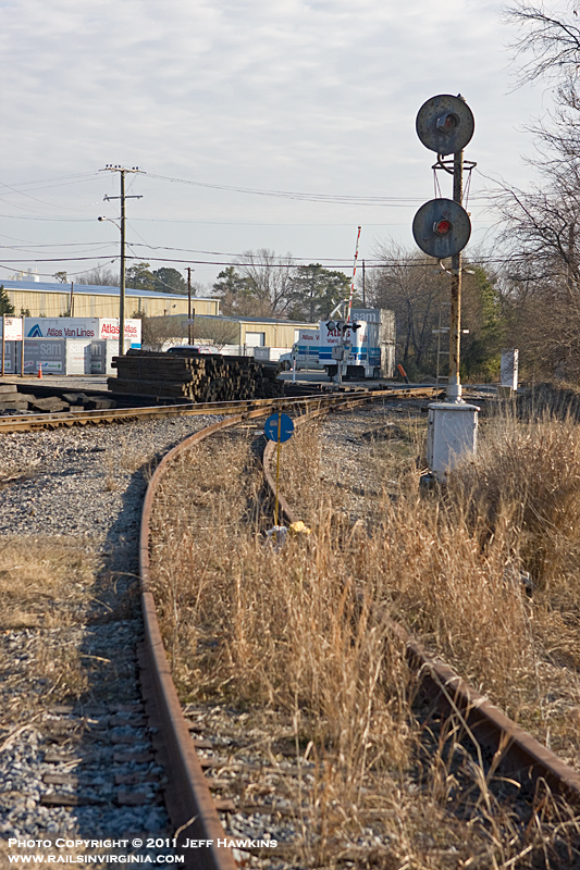
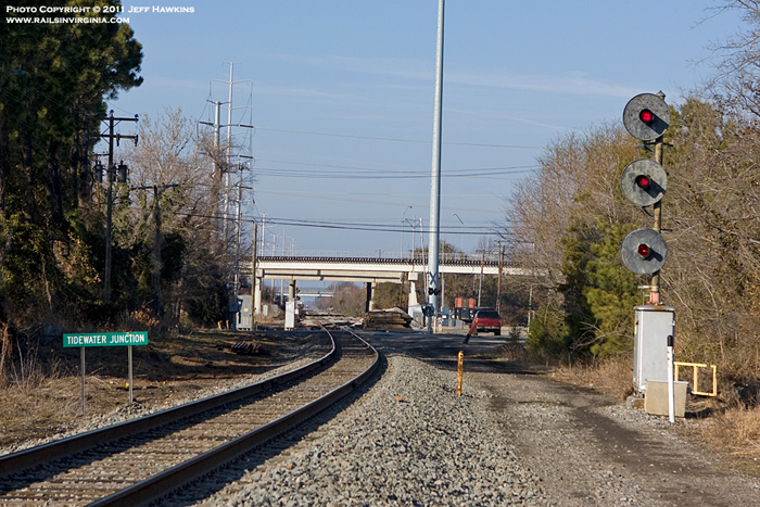
Tidewater Junction (A0.0/V2.3)
This photograph shows the westbound
signals at Tidewater Junction. The overhead
bridge carries "The Tide", which is Norfolk's light
rail system. The light rail system was built
on the former right of way of the Norfolk Southern
Railway's South Beach Route between downtown Norfolk
and Virginia Beach.
Photo by Jeff Hawkins
(December 16, 2012) |
|
Tidewater Junction (A0.0/V2.3)
This signal governed movements that
were leaving the connection track to enter the
Virginian mainline at Tidewater. Click
here for a detailed description of Tidewater
Junction.
Photo by Jeff Hawkins
(January 16, 2011) |
|
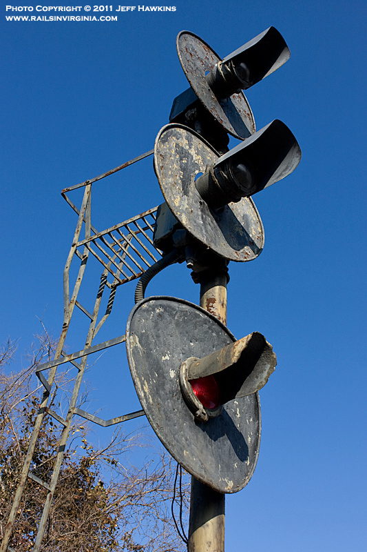
Tidewater Junction (A0.0/V2.3)
The eastbound signal at
Tidewater Junction is rather unique. It held
the distinction of being the only three head
searchlight signal on the eastern end of the
Virginian Railway. As you'll read farther down
this page, a three head signal was transplanted to
the South Norfolk interlocking after the N&W merger.
While the mainline is single track by this
installation today, it was originally double track
up until the 1970's when the original eastbound main
track was removed. During the years of double
track, there was a dwarf signal positioned opposite
of the searchlight to guard the westbound mainline
in a similar fashion to the arrangement of the
westbound signals. Despite it's bleak appearance, the
signal is still active today.
Both photos by Jeff Hawkins
(January 16, 2011) |
|
East Branch Bridge (V2.5)
The Virginian Railway spanned the
Eastern Branch of the Elizabeth River just over two
miles east of downtown Norfolk. Known as the
East Branch Bridge, the 1,748' bridge was built to
accommodate the Virginian's double track mainline
between Tidewater Junction and Carolina Junction.
To allow the passage of marine vessels, the center
section of the span was a swing bridge. In the 1970's the structure was damaged by fire.
Due to the line's significant reduction in traffic
since the 1959 merger the decision was made that the
bridge would be rebuilt with only one track.
In this photo we are looking west along the mainline
and there is a two head searchlight signal visible
on the right side of the bridge. This signal
was originally for the westbound main track but was
left in place after the bridge was reconfigured.
An identical signal was located on the west end of
the bridge, both of which have been replaced.
It is easy to see where the westbound track was
located both on the bridge and in the foreground. Also notice the telltales are still configured for
two tracks.
Photo by Marty Bernard
(Circa late 1970's)
|
|
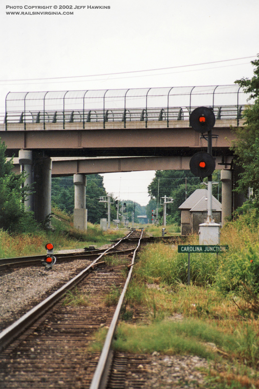
Carolina Junction (V4.3)
This view looking west at Carolina
Junction shows the westbound signals that were
replaced in 2008. The overpasses carrying
Campostella Road and Atlantic Avenue were built in
the 1990's to replace a busy grade crossing here.
Carolina Junction is where the original Norfolk
Southern Railway crossed the Virginian on a diamond
just west of the interlocking tower seen in the
distance. The diamond is now gone and two
connection tracks facilitate movements. The
Norfolk & Portsmouth Belt Line
Railroad operates over the ex-NS line
north of Carolina Junction while the
Chesapeake & Albermarle
Railroad, a subsidiary of Rail America,
leases the line south of here. Carolina
Junction was originally the west end of double
track when traveling westbound from Sewell's Point. That changed when
the Eastern Branch Bridge suffered a fire in
mid-1970's
and was rebuilt with a single track capacity thus
making the railroad single track between the west
end of the bridge and Tidewater Junction.
In the photo above the left hand track is the
mainline while the track on the right was utilized
as a switching lead for the Ford Assembly Plant
which closed in mid-2007. This view looks west at nearly two miles of right of
way.
Photo by Jeff Hawkins
(August 2, 2002) |
|
Carolina Junction (V4.5)
We are looking east along the former
Virginian mainline in this 1974 view
of Carolina Junction. A Norfolk Southern local
heads north across the diamond enroute to
interchange with the N&W at NS Junction. Note the tower
has already been boarded up by this date. To
the best of my knowledge, the diamond was removed in
the early 1980's.
Photo by Bill Whitbeck
(January 1974) |
|
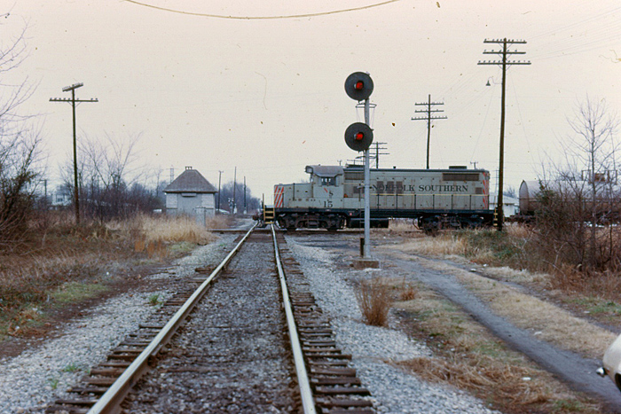
South Norfolk (V5.1)
The three head searchlight signal
seen here was a replacement for the
original two head signal that guarded
westbound movements across the diamond at South
Norfolk.
The old signal would have been located on the west
side of the Hoover Avenue grade crossing
approximately where the
photographer stood to capture this image.
After the N&W merger a new connection track was
installed in the northeast quadrant of the diamond and
joined into the former Virginian mainline on the
east side of Hoover Avenue, thus requiring the
signal to be relocated approximately 150 feet east
where it is seen in this picture. In early
2002 it was replaced with a modern Safetrans signal
that had been installed but was not yet active in
this photo from late 2001.
Photo by Chuck Rippel
(December 23, 2001) |
|
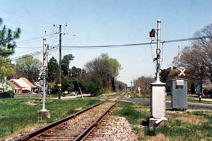
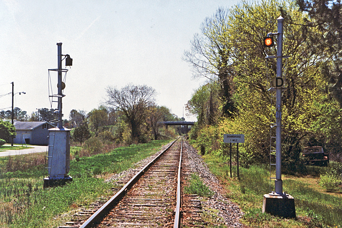
Intermediate Signals (V5.6/7)
This set of former intermediate
signals are located a half mile west of South
Norfolk at the Rodgers Street grade crossing.
They remain in service as distant signals to the NS
Norfolk District mainline to the east and the South
Branch Drawbridge (note sign) to the west. The original
searchlight style heads have obviously been replaced
with a much smaller device that displays a steady
approach indication. In the top photo, note
that the eastbound signal
still retains a "6" number plate. At one time
there would have been a "5" above it to indicate
this signal location was at mile "5.6".
In fact, although impossible to see in the bottom
photo, the bracket holding the number plate is
folded over and the "5" is still intact. The
eastbound home signal for South Norfolk would have
been just a quarter mile in the distance. Also
note the Virginian whistle post in the distance in
the top photo.
Photo by Jeff Hawkins
(April 2003) |
|
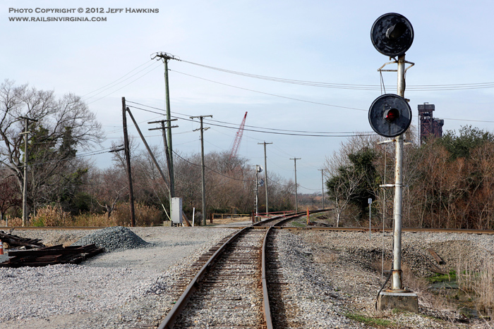
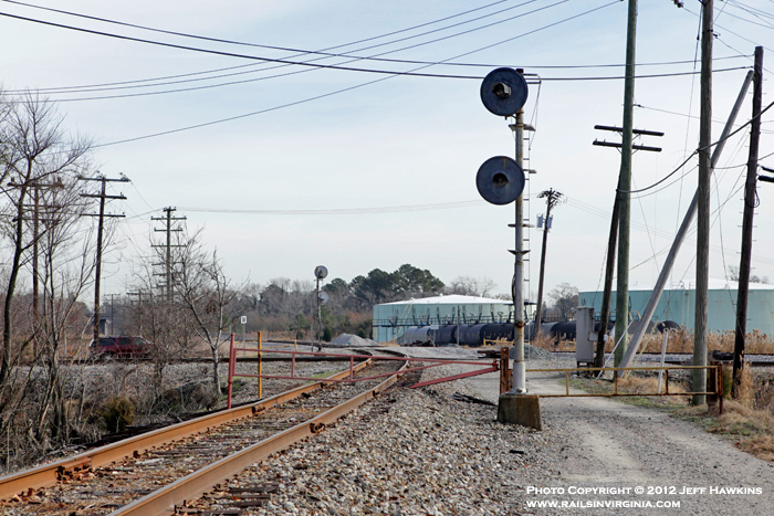
Belt Junction (V6.5)
After crossing the N&W mainline at
South Norfolk, the Virginian The Norfolk &
Portsmouth Beltline Railroad ran down the east side
of the Elizabeth River's Southern Branch. The
top photo is looking west towards the South Branch
Bridge which is visible to the right of the signal
heads. In the bottom photo we are looking east
towards South Norfolk.
Both photos by Jeff Hawkins
(December 2012) |
|
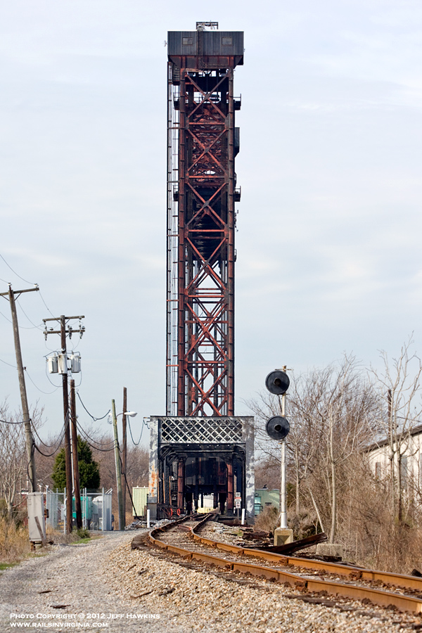
South Branch Bridge (V6.8)
Originally built as a swing bridge
similar to the Eastern Branch Bridge, the South
Branch Bridge was converted to a lift span in 1974.
This was done so larger ships could gain access to
the South Branch of the Elizabeth River beyond this
point. At present GRS searchlight signals
still guard each end of the bridge. The photo
above is looking west. It appears the signal
was mounted on a new base as the old base is visible
to the right of the current installation.
Norfolk Southern employee timetables identify this
as the South Branch Drawbridge.
Photo by Jeff Hawkins
(December 2012) |
|
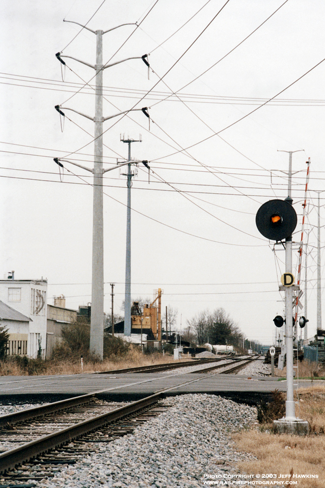
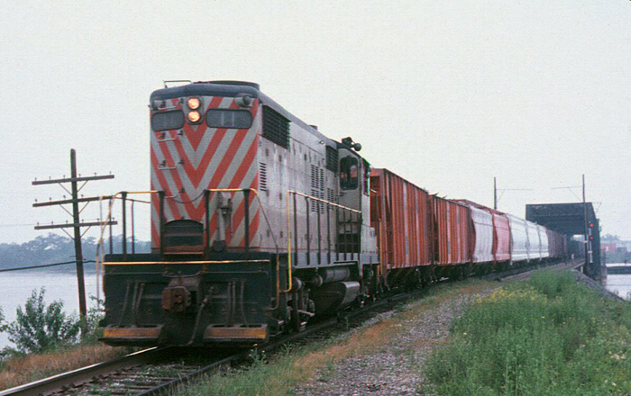
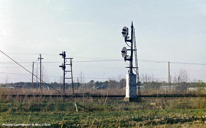
Algren (V15.4)
This photo illustrates the
proximity in which the Virginian and Seaboard Air Line operated in this
area. Between Suffolk and Algren, a distance of 13 miles, the two
railroads paralleled each other less than 100' apart. In this
photograph we see the eastbound home signals for the diamond at Algren.
The SAL mainline is in the foreground with a familiar Virginian
searchlight signals looming in the distance. Visible beyond both
signals are
vehicles traveling eastbound along US 460.
Photo by Walt Gay
(Circa 1970) |
|
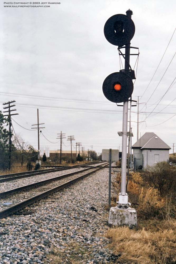
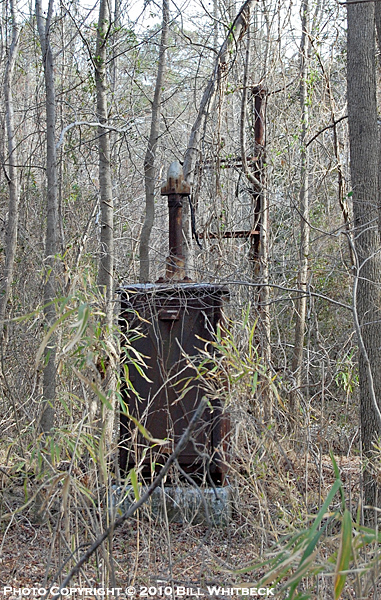
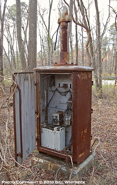
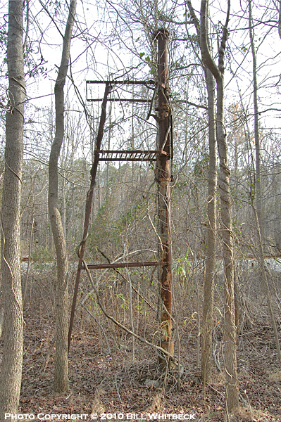
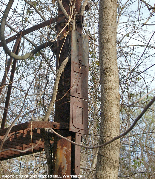
Algren (V17.0)
The four proceeding
photographs show the remnants of the eastbound distant signal to the
diamond at Algren. As noted by the number plates in the above
photo, the signal was located at mile 17.0. In the third photo you
can see the former SAL mainline (now the CSX Portsmouth Subdivision)
which ran parallel to the Virginian between Algren and Suffolk.
Many thanks to Bill Whitbeck for braving the elements to capture these
images.
Photos by Bill
Whitbeck (March 2010) |
|
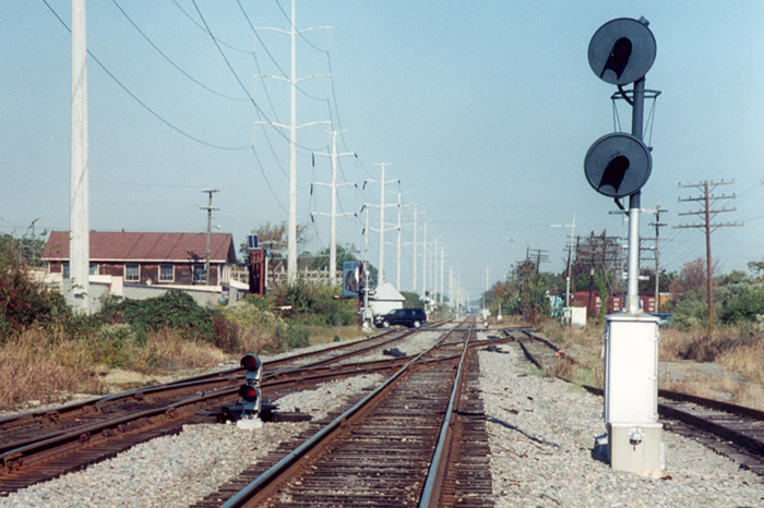
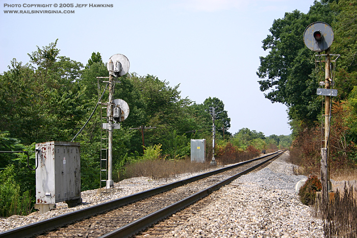
Oakvale (V329.5)
Looking west at the searchlights in Oakvale, WV.
This segment of the railroad was not signaled under
Virginian ownership, which means these signals were
relocated here from elsewhere on the railroad after
1959. Another telltale sign these aren't
premerger signals are the number plates. The
Virginian installed vertical plates as seen on the
signal at Algren. Clearly these are horizontal
and more modern in nature. This August 2005 photo shows
the new signals visible in the distance next to the
electrical box. In 2009 Norfolk Southern
activated the new signals and the searchlights were
removed with only the concrete bases serving as the
only reminder of these
Photo by Jeff Hawkins
(August 14, 2005) |
|
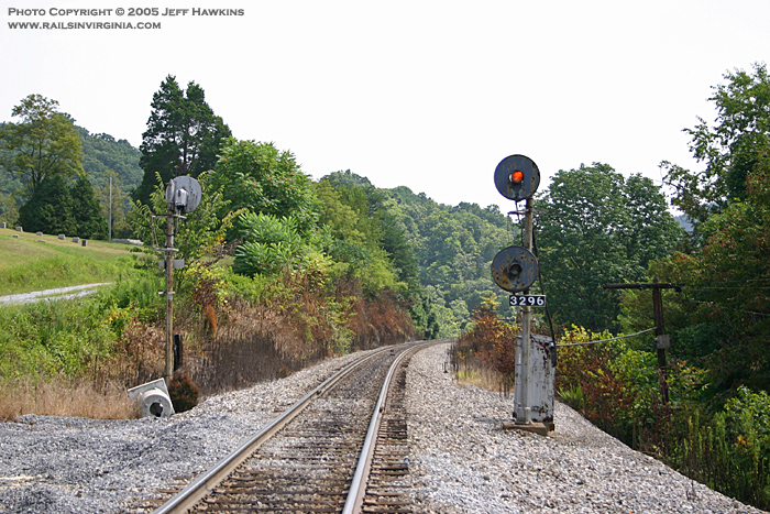
Oakvale (V329.6)
The view looking east at Oakvale.
The eastbound signal is displaying it's normal
aspect, approach, which indicates a stop signal at
the next interlocking, PD Junction.
Photo by Jeff Hawkins
(August 14, 2005) |
|
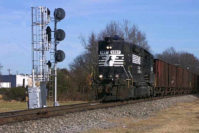
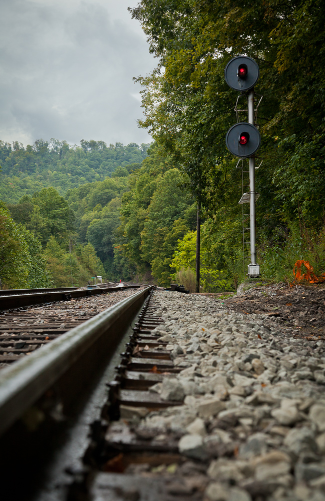
Weyanoke (V358.1)
Weyanoke is the east end of the
double track over Clarks Gap. The searchlight
signals here were replaced on December 5, 2012.
Photo by Samuel
Phillips
(September 1, 2012) |
|