|
Abandoned Rails
<
Main Page
The Norlina Subdivision
Petersburg, VA to Norlina,
NC
|
Many railfans and railroaders
alike will argue
that one of the most controversial abandonments ever made by CSX was the former Seaboard Air Line
Railroad (SAL) mainline between South
Collier, VA and Norlina, NC. Regardless of one's opinion, the line is no more.
Under SAL ownership the line between Richmond and Raleigh was known as
the Richmond Subdivision. After the formation of the Seaboard
Coast Line Railroad (SCL) on July 1, 1967 the route was identified as
the Norlina Subdivision. A practice which continues to this day
with the active segment between Ridgeway, NC and Raleigh.
Almost immediately following the
1967 merger with the ACL, the mainline between Centralia to Petersburg was
abandoned in favor of using the existing ACL mainline (A-Line). In
late 1986
CSX shuttered the Norlina Subdivision and the tracks
were removed the following summer.
-
CSX began rerouting through manifest and
intermodal trains off the Norlina Subdivision on November 9, 1985.
This included trains R460, R461, R465, R190, R191 and R192.
-
The last scheduled passenger train was Amtrak 81
which ran on Sunday, October 26, 1986. The last northbound
Amtrak 82 ran the prior day on October 25, 1986.
-
The last non-passenger train to run over
the Norlina Subdivision between Norlina and Collier Yard was a northbound work train consisting of
one engine and ten cars. It departed Raleigh at 10:30 PM on
December 31, 1986 and arrived in Petersburg at approximately 1:00 AM
on January 1, 1987.
-
The last official train operated over
the line was a rail train in March 1987.
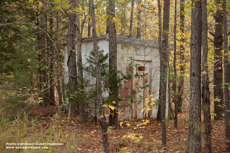
Defect detectors were
located as follows: Burgess (32.6), McKenney (45.7), Cochran (62.3), and
Hagood (82.5). Between Norlina and Raleigh detectors could be
found at Middleburg (106.1), Franklinton (131.2) and Neuse (147.4).
All were the SAL's standard white cinderblock buildings. There was also
a detector
located at Chester prior to that portion of the line being abandoned in
1970. There was orginally a detector at La Crosse (78.06) prior to
Hagood being placed in service in 1964. The detectors at McKenney,
La Crosse and Middleburg were active as of March 1961 according to FCC
records. All seven defector detectors are still standing as of
late 2014.
The SAL and SCL maintained
radio stations at the following locations between Petersburg and
Norlina: Dewitt (41.7), Alberta (61.1), La Crosse (78.0) and Norlina
(98.2). All four radio station buildings are still standing as of
late 2014. The radio station at La Crosse was originally the
aforementioned defect detector.
Thanks to the generous
contributions, both in the form of photographs and information, from
Steve Hammer, Herman Wilkins, Walt Gay, Jeff Allgood, Ryan Riddell,
Staunton Cottrell , Doug Riddell and Chris Astle Jr. This page would not exist without their help.
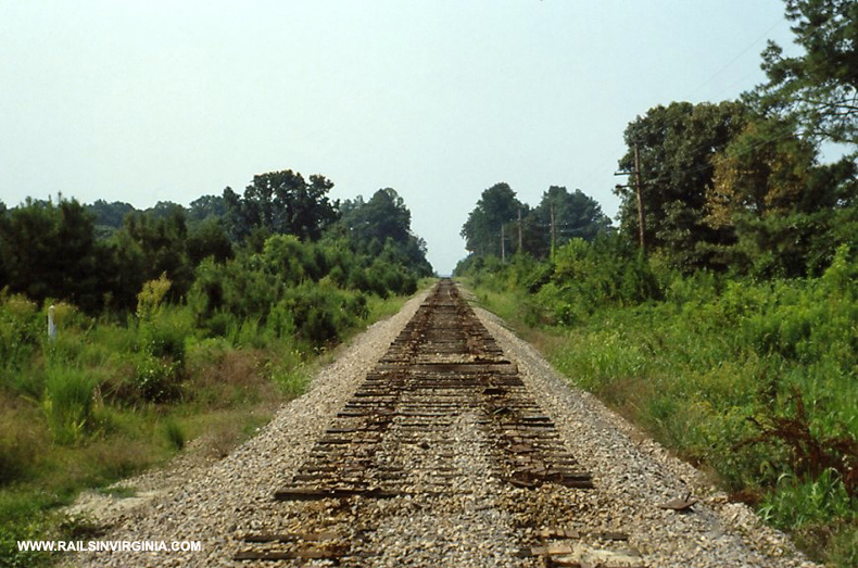
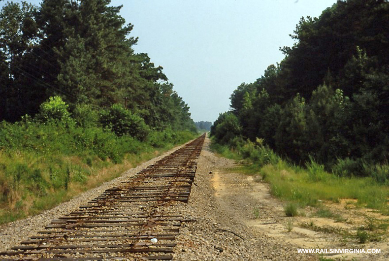
It should be noted that most of the views seen below are not possible
anymore due to extensive overgrowth. For additional photos of the modern day Norlina Subdivision,
click here.
If you would like to
contribute material, please
e-mail me.
|
|
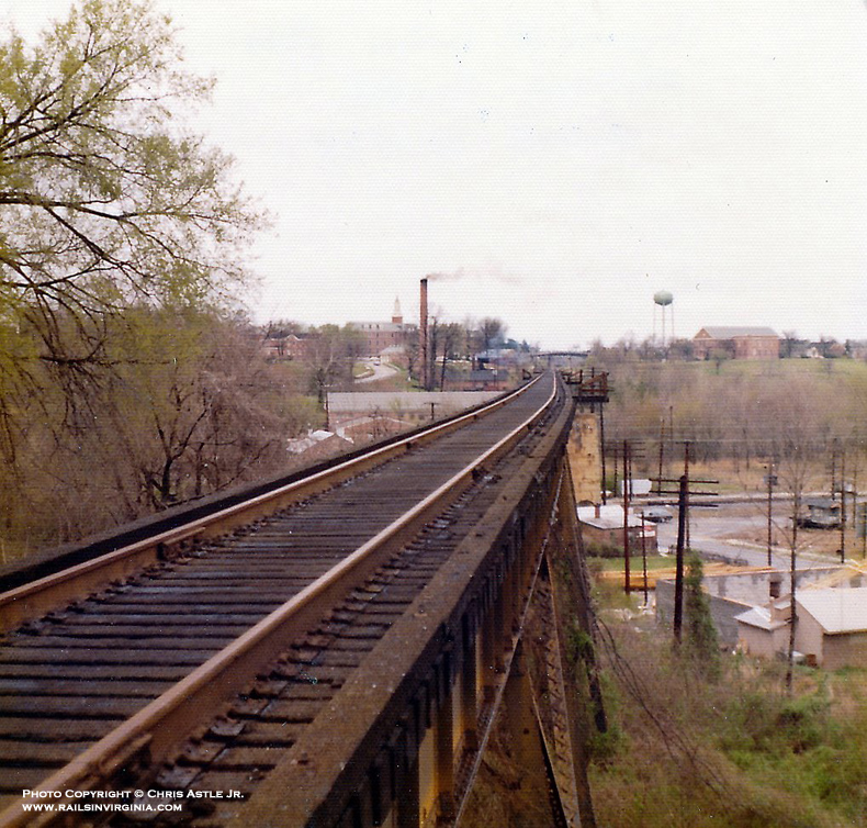
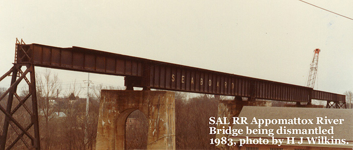
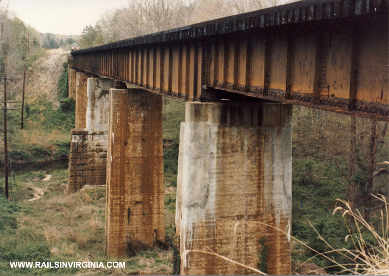
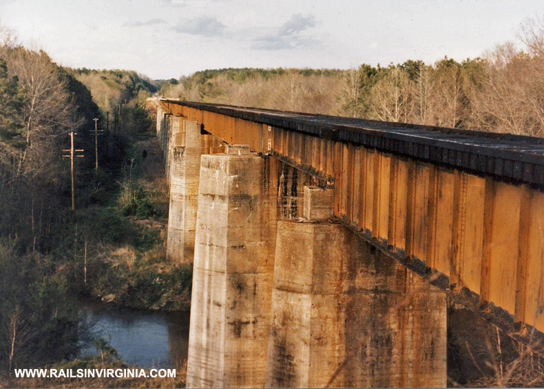
Petersburg - Appomattox River Bridge (S22)
The
Seaboard's ominous bridge spanning the Appomattox River
in Petersburg was built in 1931 and measured over 2,000' in length.
While the bridge is gone the five massive
concrete piers still stand to this day.
Top photo by
Chris Astle Jr. (March 30, 1974)
Bottom photo by Herman Wilkins
(1983)
Petersburg - ACL Bridge
Looking railroad north (compass east) along the SAL roadbed where it passed
under the ACL mainline in Petersburg.
Photo by
Walt Gay (2013)
Burgess (S32.4)
This photo is
looking north from the old Quaker
Road grade crossing. The mainline track was on the left and the
siding was on the right. Barely visible in the distance are the
Interstate 85 bridges. The S.E. Burgess interlocking was several
hundred feet behind the photographer.
Photo by
Walt Gay (1987)
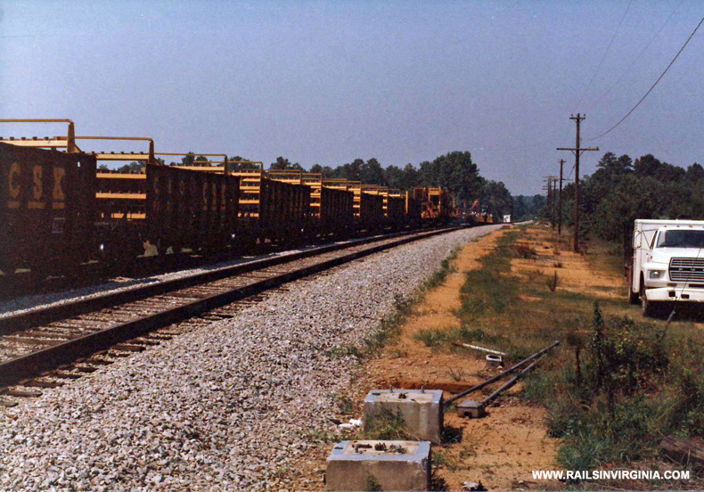
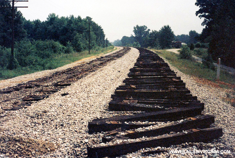
S.E. Burgess (S32.4)
A
CSX rail train is in the process of removing rails at the former S.E. Burgess interlocking
during the summer
of 1987. The white building visible in the distance is the Burgess
defect detector.
Photo by
Walt Gay (1987)
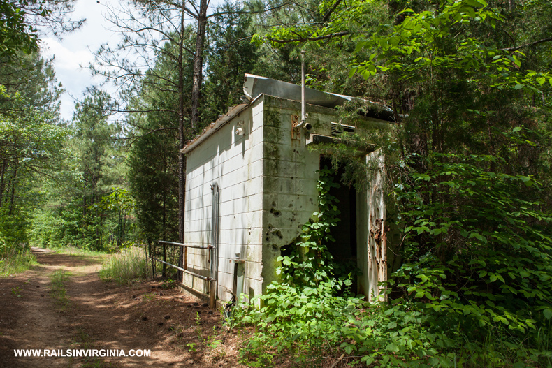
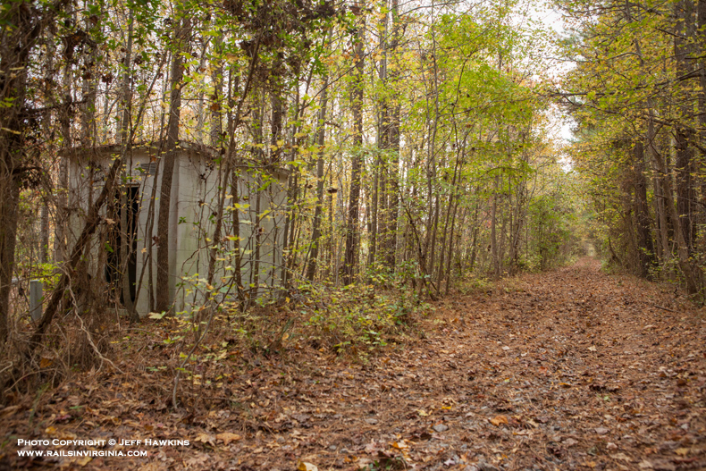
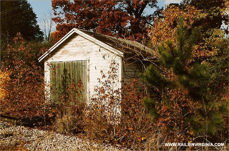
Burgess DD (S32.6)
Hiding amongst the trees and
vegetation is the old SAL defect detector at
Burgess. The mainline track was located on the
other side of the structure as seen in the previous
photo. Yes, this is the same location.
It illustrates just how grown up much of the right
of way has become.
Photo by Jeff Hawkins
(May 25, 2014)
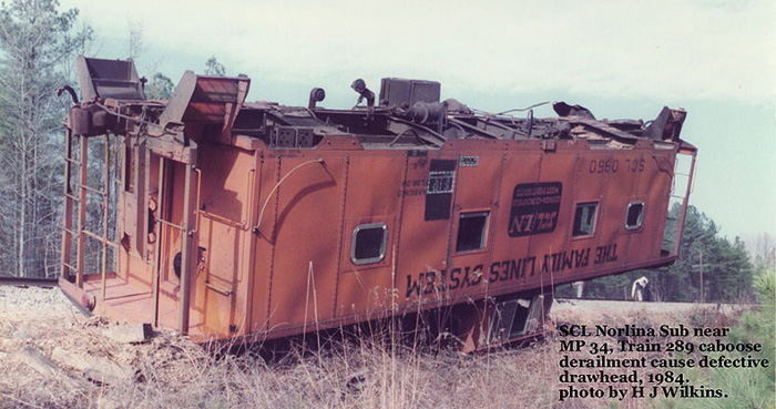
Milepost 34 (S34)
SCL caboose
No. 0950 from train 289 has
overturned at milepost S34 during a derailment in 1984.
Photo by Herman Wilkins (1984)
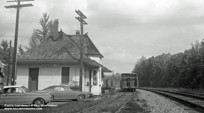
Dinwiddie - Depot (S37.5)
SCL caboose
No. 0950 from train 289 has
overturned at milepost S34 during a derailment in 1984.
Photo by Bill Monypenny - 1970 (Brian Ezzelle Collection)
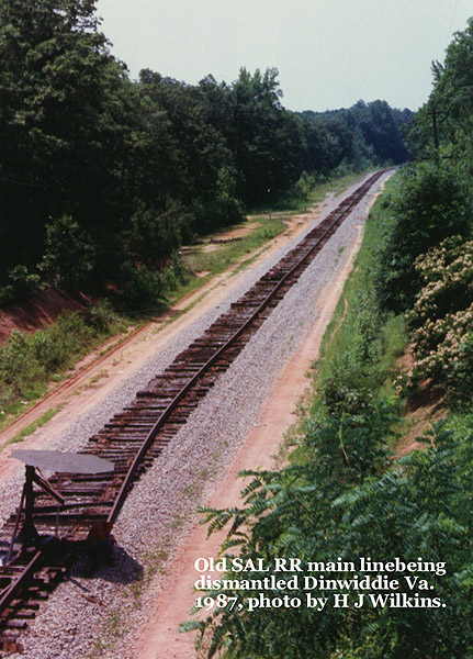
Dinwiddie (S37.7)
The beginning of the end. CSX
crews are busy removing the rails through Dinwiddie County. From here on out,
only memories will remain of trains passing through Dinwiddie.
This photo was taken looking south from the Courthouse Road bridge.
Photo by Herman Wilkins (1987)
Stony Creek (S38.8)
Looking north at the bridge over Stony Creek just south of Dinwiddie.
Photo by Walt Gay (1992)
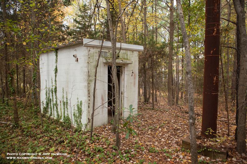
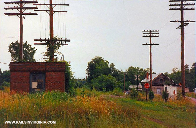
Dewitt - Radio Station (S41.7)
The northernmost radio station located on the Norlina Subdivision was at
Dewitt. Visible on the right is one of two antennas still standing
here, including one on the opposite side of the building that is well
over 100' tall.
Photo by Jeff Hawkins (November 9, 2014)
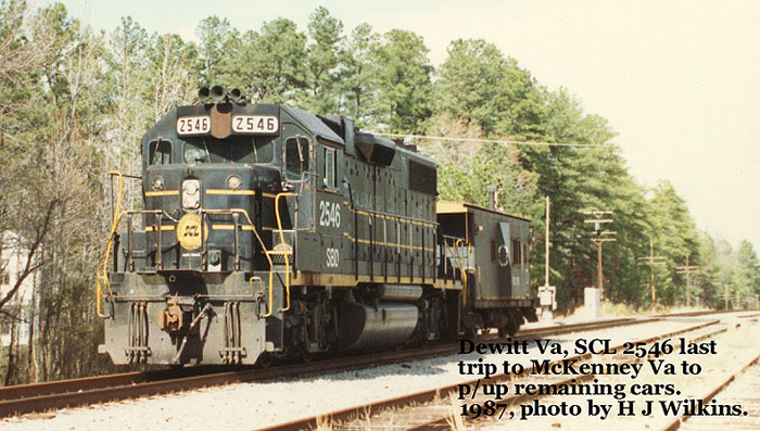
Dewitt (S41.8)
Just prior to abandonment, SCL GP38-2
No. 2546 is
seen passing through DeWitt to pick up the last few cars at McKenney.
Photo by Herman Wilkins (1987)
S.E. Dewitt (S42.6)
Looking south where the S.E. Dewitt interlocking was located. The
base for the northbound signal can be seen in the distance near the
center of the photo.
Photo by Jeff Hawkins (April 10, 2014)
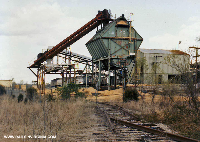
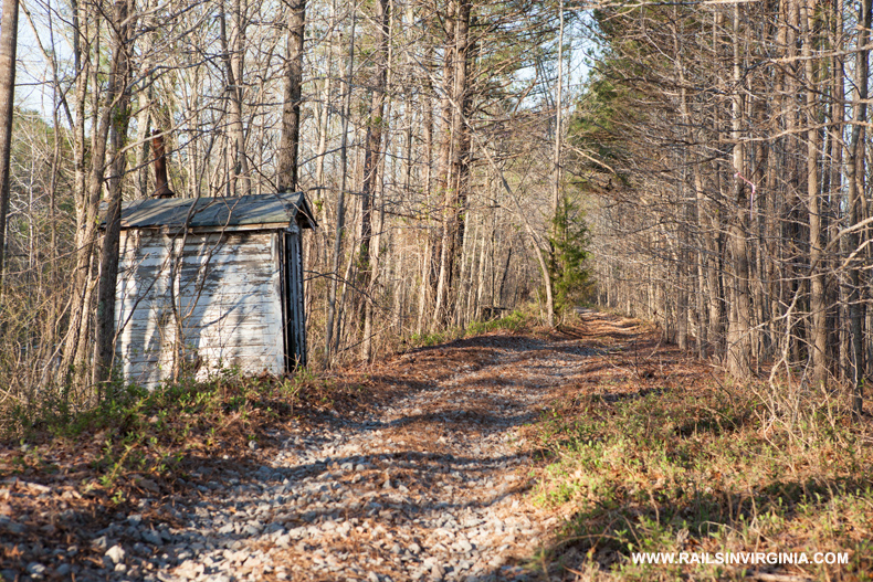
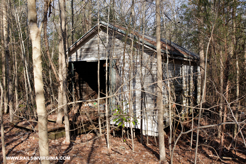
Georgia Pacific Chip Mill (S45)
This wood chip mill was located a
few miles north of McKenney along U.S. Route 1. Author and historian Bill Griffin
recounts this as being the only active shipper between South Collier and McKenney at the time CSX abandoned the Norlina Subdivision.
Photo by Walt Gay (Date Unknown)
McKenney DD (S45.7)
The old SAL hot box detector at
McKenney. The bottom photo is looking south with the
detector barely visible on the left.
Photos by Jeff Hawkins
(November 9, 2014)
McKenney - Station (S47.7)
Walt Gay photographed the modern SAL station at McKenney
several years after
the line was abandoned. This is a replacement for the original
passenger station and was built in 1964. The station has been
incorporated into a large industrial building that now spans the old roadbed
and only the south end of the structure is visible.
Photo by Walt Gay (1992)
Nottoway River (S50.7)
Looking north at the Nottoway River bridge just south of McKenney.
Photo by Walt Gay (1992)
Alberta
- SAL/VGN Crossing (S61.1)
These two photos are looking south at the location where the Virginian
Railway (VGN) crossed over the SAL. As you can see the trees grew
quite a bit in a 23 year span. The SAL was completed through
Alberta in 1900 while the VGN laid it's tracks down through town in
1906, spanning the Seaboard on a bridge.
Top photo by Steve Hammer (July 1991)
Bottom photo
by Jeff Hawkins (April 10, 2014)
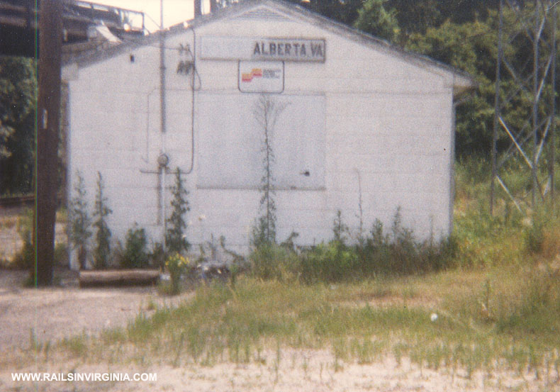
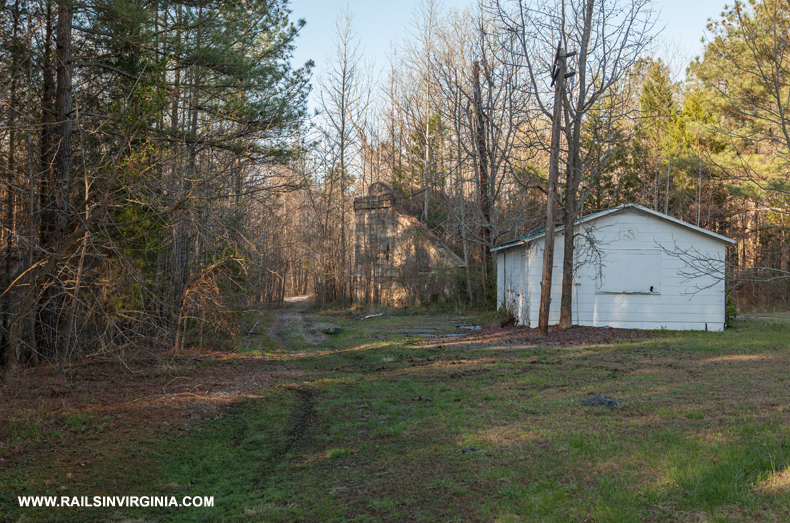
Alberta - Station (S61.1)
Jeff Allgood
took this photo of the modern SAL station in Alberta during the last year
the Norlina Subdivision was active. This station was built in 1959
and
still stands today in fairly decent condition and even rates a new roof. At
this time the Norfolk Southern (ex-VGN) line was still active and part
of the bridge spanning the Norlina Subdivision is visible in the top left corner of the
photo. Norfolk Southern operated the
last official train thru Alberta on April 22, 1988.
Photo by Jeff Allgood (1986)
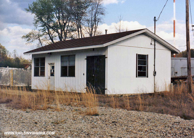
Alberta - Radio Station (S61.1)
Positioned opposite the right of way from the station is the Alberta
radio station building. There are no antennas remaining at this
location.
Photo by Jeff Hawkins (November 9, 2014)
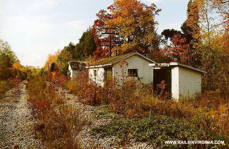
Alberta - MOW Buildings (S61.3)
Steve Hammer captured the fall colors at near peak in October 1992 when
he photographed a trio of MOW buildings in Alberta. Although it
was five years post abandonment, the right-of-way is surprisingly open.
Fast forward to the Spring of 2014 and the same three buildings are
still standing in good condition. It was noted that several code
line poles are still standing nearby as well.
Top photo by Steve Hammer (October
1992)
Bottom photo
by Jeff Hawkins (April 10, 2014)
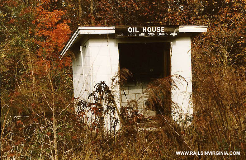
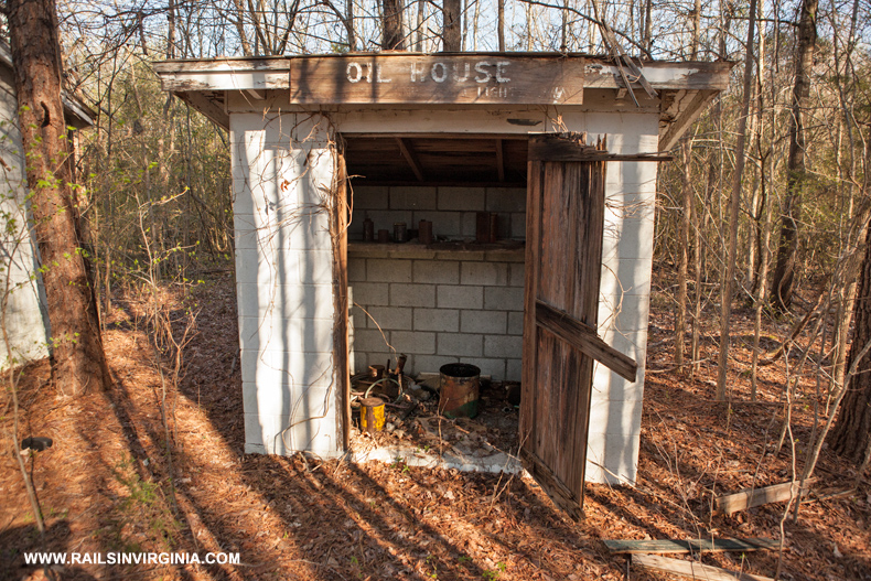
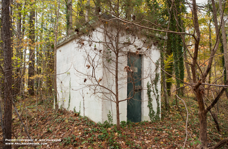
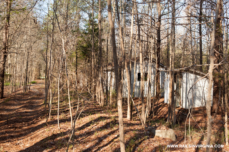
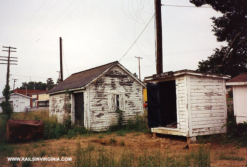
Alberta - Oil House (S61.3)
The old oil house in Alberta
still stands
amongst
the rapidly growing weeds.
Top photo by Steve Hammer (October 1992)
Bottom photo
by Jeff Hawkins (April 10, 2014)
Alberta
- Tool House (S61.3)
Another building located in Alberta.
Top photo by Steve Hammer (October 1992)
Bottom photo by
Jeff Hawkins (April 10, 2014)
Alberta
- MOW Building (S61.3)
Yet another structure from Alberta.
Top photo by Steve Hammer
(October 1992)
Bottom photo
by Jeff Hawkins (April 10, 2014)
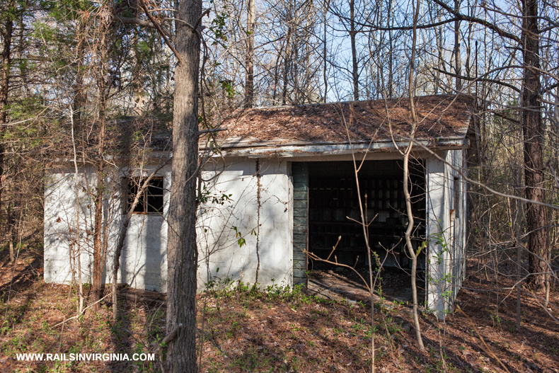
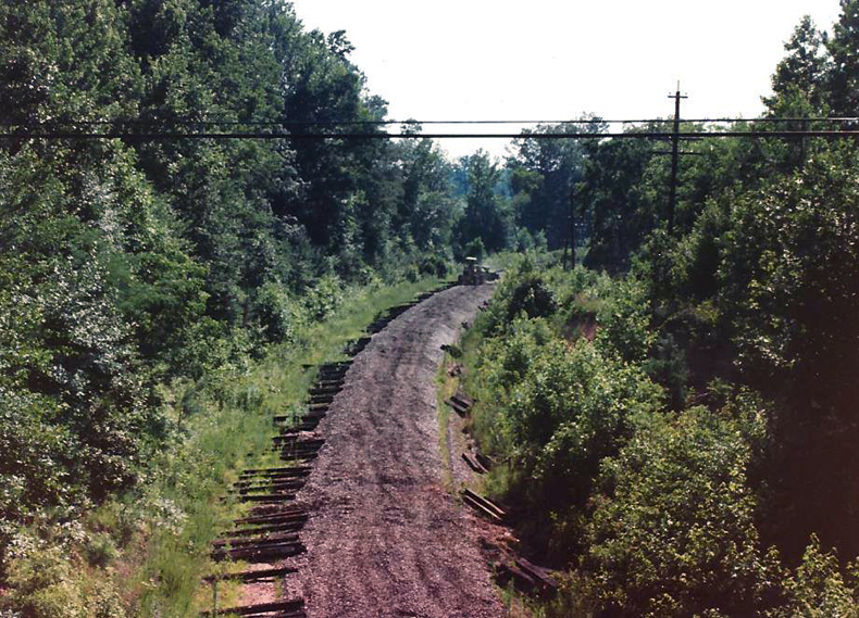
Cochran DD (S62.3)
Standing amongst a barren area that
was recently harvested for timber, the old defect
detector at Cochran still stands adjacent to the old
roadbed.
Photo by Jeff Hawkins
(May 25, 2014)
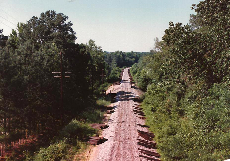
Cochran - Route 1 Bridge (S63)
These views were taken from the
bridge that carried the northbound lanes of U.S.
Route 1 over the Norlina Subdivision.
Photos by Kenny
Daniels
(July 1987)
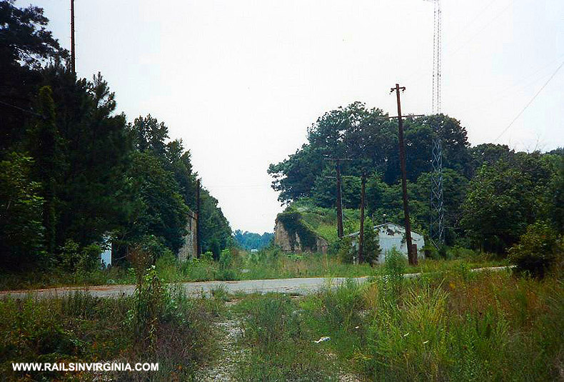
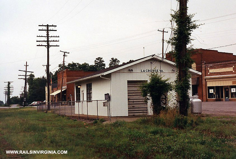
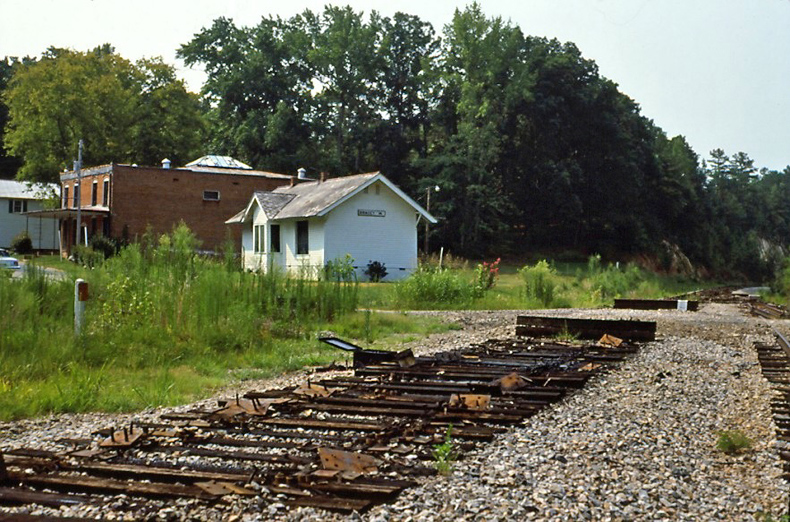
La Crosse (S78.9)
Another town that once hosted two railroads is La Crosse. In
addition to the SAL, the Norfolk, Franklin & Danville ran east/west
through town crossing the Seaboard on a diamond that was located just to
the right of center in both of the above photographs. Both views
are looking north and in the top photo the U.S. 58 bridge is barely
visible in the center of the frame. Today very little from the
1992 photo remains except for one pole and the stop sign.
Top photo by Steve Hammer (June 1992)
Bottom photo by
Jeff Hawkins (April 10, 2014)
La Crosse
(S79)
The oil house along with
two unidentified railroad buildings in La Crosse. All three structures have since been
demolished. Note the station visible in the left of the photo.
Photo by Steve Hammer (June 1992)
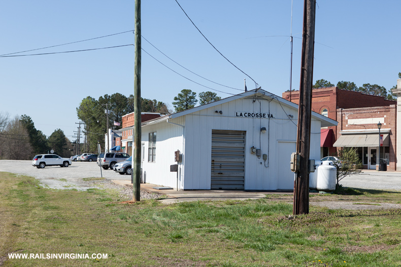
La Crosse (S79)
In June 1992 Steve Hammer photographed the SCL era station that served La Crosse. The right-of-way is located on the very
left edge of both photos.
While the code line poles are gone, the building remains and now serves
as the town office. The name La Crosse is derived from the fact
that two railroads once crossed. During the steam era, La Crosse
was one of four water stations on the SAL between Richmond and Raleigh.
The others three were located at McKenney, Cochran and Norlina.
Top photo by Steve Hammer (June 1992)
Bottom photo
by Jeff Hawkins (April 10, 2014)
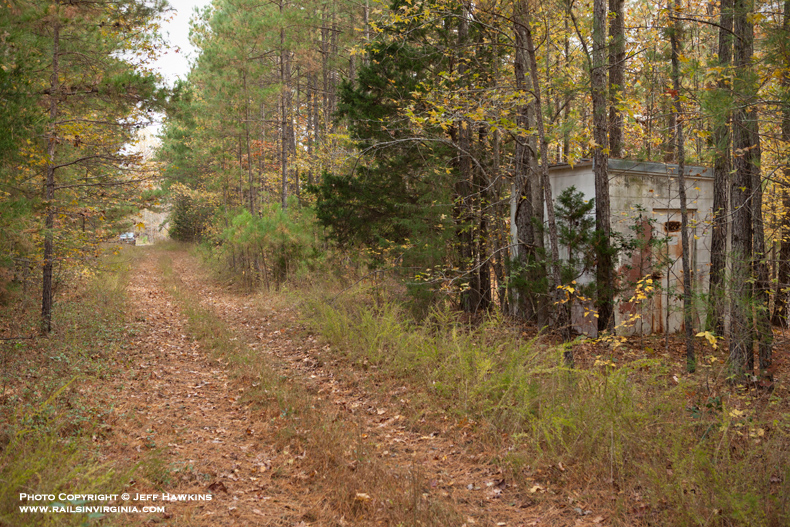
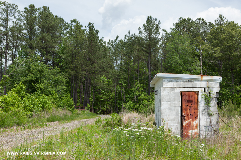
Hagood DD (S82.5)
The old SAL hot box detector at
Hagood. The detector was placed in service at
6:00 PM on May 28, 1964. This detector
replaced the original installation at LaCrosse
(S78.06).
Photos by Jeff Hawkins
(November 9, 2014)
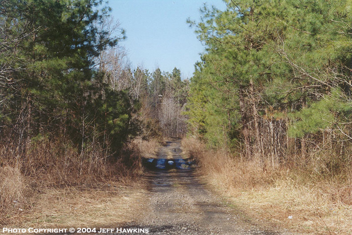
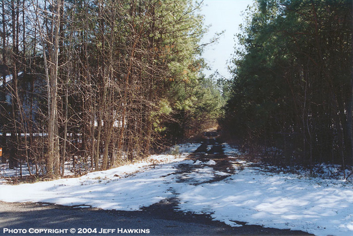
Bracey (S86.5)
Looking
north from what used to be the Bracey Drive grade crossing. The
station was orignally located off to the left.
Photo by Jeff Hawkins (February 2004)
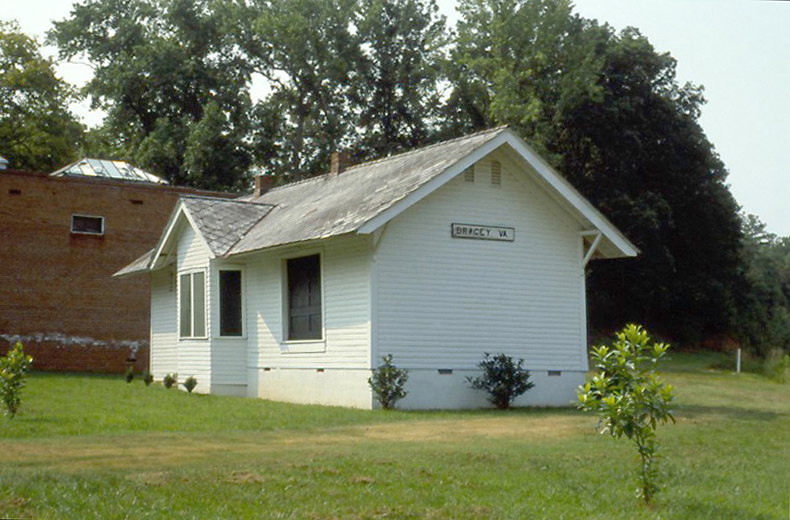
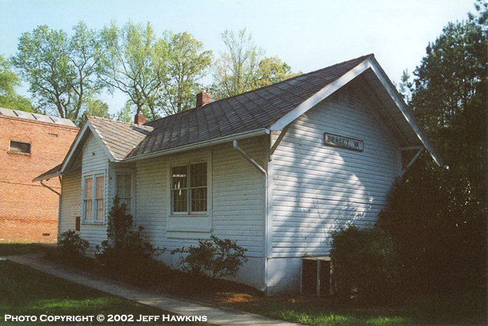
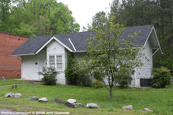
Bracey Depot (S86.5)
The old depot in Bracey is now privately owned and
still looks respectable in this modern view.
This photo shows how the depot
appeared in April 2008. Note that the "BRACEY, VA" sign on the end
of the building is now gone. I don't know if this was removed by
the owners for safe storage or if it was stolen.
Top photo by Brian Ezzelle (July 26, 1987)
Middle
and bottom photos by Jeff Hawkins (April 2002 & April 2008)
Bracey (S86.5)
Looking south
from what used to be the Bracey Drive grade crossing. The depot is visible through the trees in the left of the
photo.
Top photo by
Brian Ezzelle (July 25, 1987)
Bottom photo by Jeff Hawkins (February 18, 2004)
Bracey (S83.7)
The view looking south from the Highway 903
overpass towards Lake Gaston.
Photo by Jeff Hawkins (April 2008)
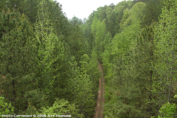
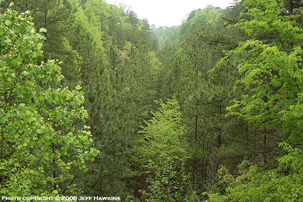
Bracey (S86.5)
The view looking north from the Highway 903
overpass. This deep cut was known as the "Grand
Canyon of the East" by Seaboard crews. The
northbound grade was a stiff one as the line rose in elevation as it
left Lake Gaston.
Photo by Jeff Hawkins (April 2008)
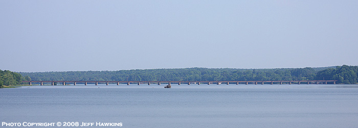
Lake Gaston Bridge (S88.6)
This photo was taken from Interstate 85 and
shows the Seaboard's nearly 3,000' long bridge across Lake Gaston.
Photo by Jeff Hawkins (April 2008)
Wise (S95)
Brian Ezzelle took these views looking north and south at
Wise, NC shortly after the rails had been removed.
Photos by Brian Ezzelle (July 25, 1987)
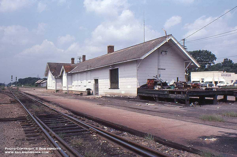
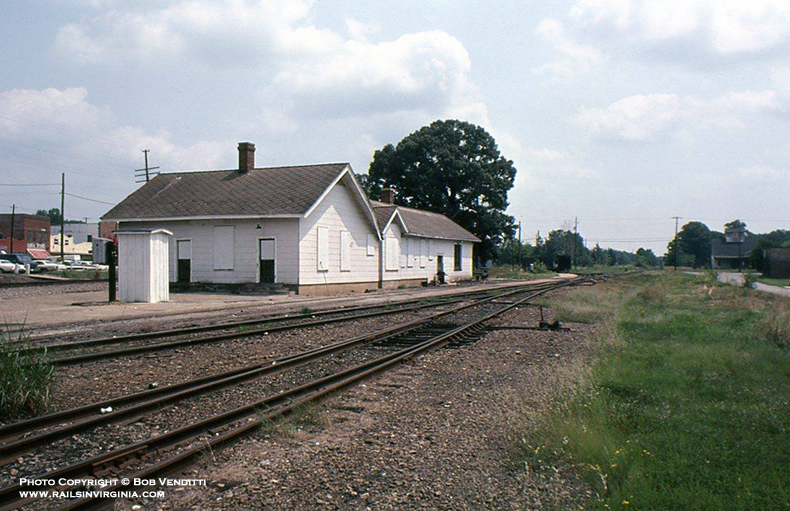
Norlina - Depot (S98)
Originally known as Ridgeway Junction, the Town of
Norlina was founded in 1900. These photos show the station in the
waning years of the Norlina Subdivision. It is believed that the
station was demolished in 1987 in conjunction with the line north of
Norlina being removed.
Photos by Bob Vendetti (Circa early 1980's)
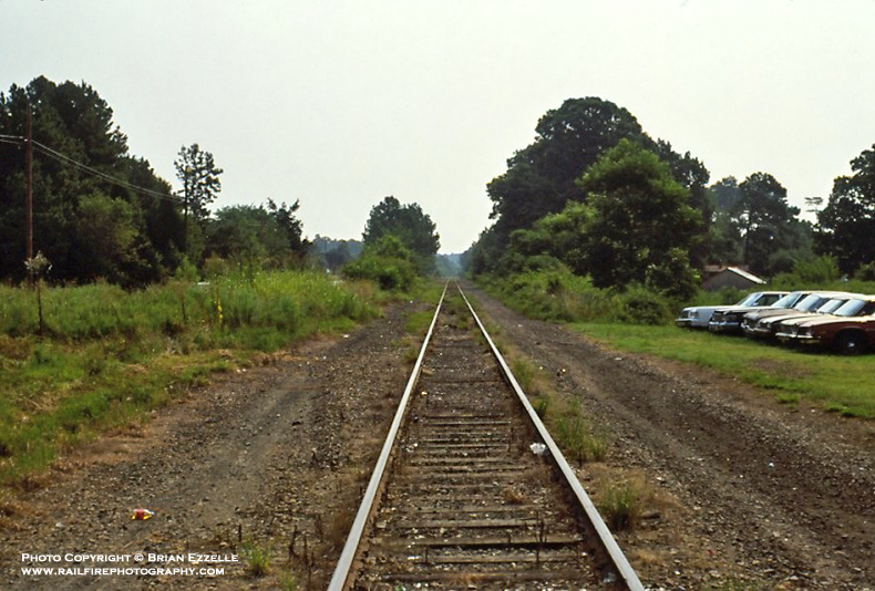
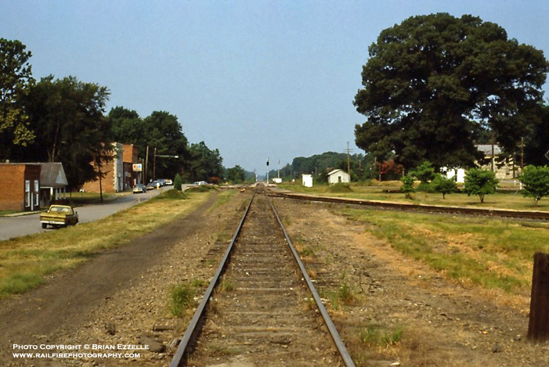
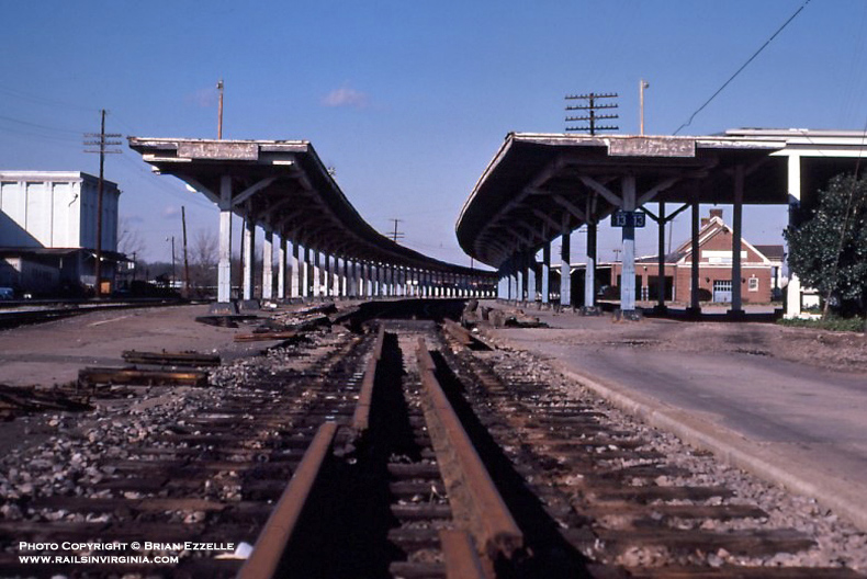
Norlina (S98)
This pair of images is looking east to Portsmouth and
south towards Raleigh respectively. It's the summer of 1987 and
the rails to Richmond have been removed and the depot has been torn
down. A sharp eye will also detect that the signal heads in the
distance have been turned.
Photos by Brian Ezzelle (July 25, 1987)
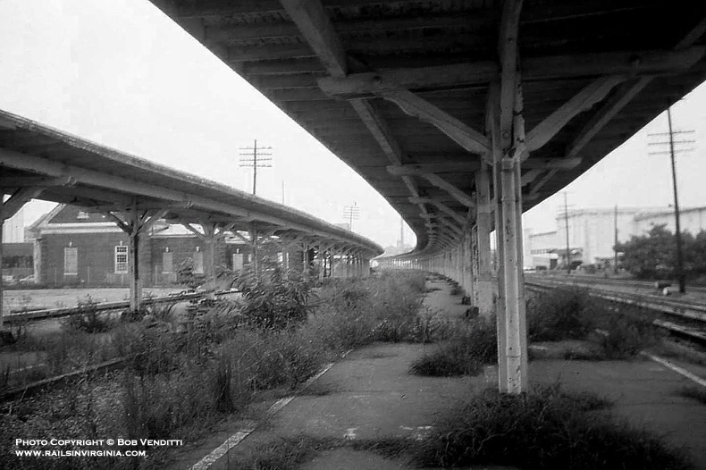
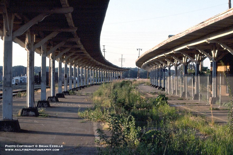
Raleigh (S156)
This trio of photographs show the former SAL passenger
station in Raleigh in the years following the end of passenger service
north of Raleigh via the Norlina Subdivision. The station was
known the Bagwell Station and was named for Mr. Eugene C. Bagwell, an
officer of the railroad. It was located at the south end of the
SAL's Johnson Street Yard. The Bagwell Station served 14 trains
daily when it opened on September 28, 1942. From late 1986 to 1991
the property sat unused until a garden center opened for business, and
is still in operation as of late 2014. Both the station and train
sheds remain standing and in good condition. The
Seaboard Cafe
also operates inside the former SAL Bagwell Station.
Top photo by Bob Vendetti (1988)
Middle photo
by Brian Ezzelle (August 10, 1990)
Bottom photo
by Brian Ezzelle (February 1987)
|
|