|
Abandoned Rails
<
Main Page
N&W Signs and Markers
|
This page illustrates a number of the signs and
markers that the N&W utilized along
it's right of way. Titles and descriptions are
per the N&W Standards Drawings book published by the
N&W Historical Society. All items are listed
in alphabetical order by their title.
If you have any
information or photos
you'd like to contribute, please contact me at
jl.hawkins@comcast.net.
|
|
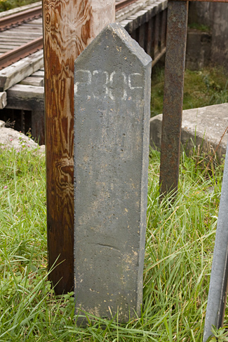
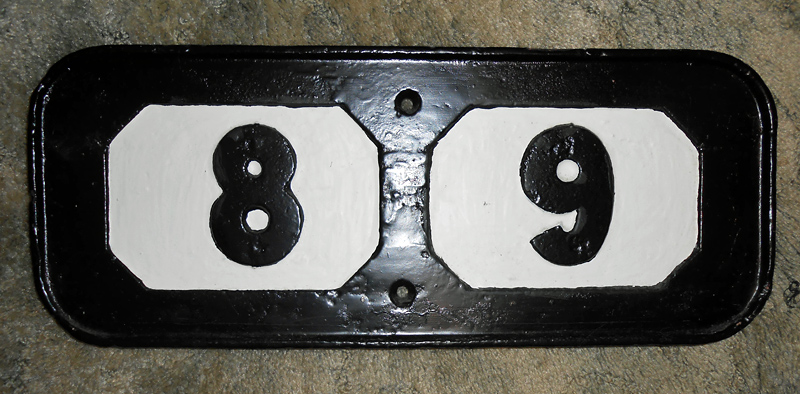
Bridge Identification
Post
The N&W assigned each bridge
throughout it's system a number for identification
purposes. They were numbered in
sequence by the engineering
department and had no relationship
to milepost locations. For
example, in the Tidewater area
Bridge 5 was the bridge over the
Eastern Branch of the Elizabeth
River and Bridge 7 was the bridge
over the Southern Branch. Several
short bridges in the Petersburg, VA
area were numbered 24 through 31.
The concrete posts were painted
black with the bridge number painted
in white on each side.
N&W expert Louis
Newton explains: "Numbers continued
west on the main line, but each
district had it's own group of
numbers. The bridges on
Winston-Salem District, for example,
were numbered in the 1800 series
going south from Roanoke. On the
Clinch Valley, they were in the
1300 series, with Bridge 1301 at
Bluefield, VA, and Bridges 1396 and
1397 being a couple of the big
trestles on Bull Mountain. On the
Cincinnati District they were in the
2000-series, with No. 2001 being the
Scioto River bridge at Vera and
No. 2080 the Little Miami Bridge at
Clare."
Shown above are bridge identification
markers located on the former Bluestone Branch,
which was last used in the mid-1980's. The
marker on the left is weathered so heavily that any
evidence as to it's number has long been erased.
Seen on the right is the marker for Bridge 2305 in
Matoaka, WV, also on the Bluestone Branch.
The webmaster is aware of numerous other bridge
markers on abandoned lines, but only two that still
stand along active NS tracks.
Today Norfolk Southern identifies a bridge by it's
location in relation to the mileposts. These
numbers are usually painted on the bridge. For
example, the bridge over US 52 at Maybeury, WV on
the Pocahontas District is
marked "N378.64".
Both photos by Jeff Hawkins
(Left: October 21, 2010 - Right: October 18,
2009) |
|
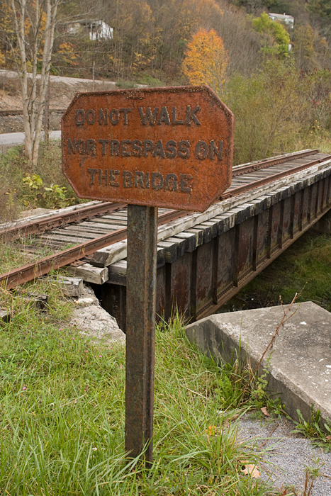
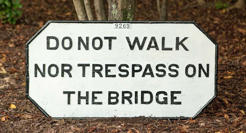
Bridge Trespass Sign
The no trespassing signs were
installed at each end of bridges over 100' in length
or where the greatest distance from the top of the
bridge to the ground exceeded 12'. The
sign read "DO NOT WALK NOR TRESPASS ON THE BRIDGE"
and was made primarily from scrap iron.
Earlier signs were made of wood as evidenced by this
photo from Maybeury, WV. The cast iron
signs were mounted on posts that consisted of old 56
or 67 pound rail. The raised letters were
painted black with the background being white. The
specimen above stands at one of the many bridges
along the former N&W Bluestone Branch.
A good many stood alongside mainline bridges into the late
1980's with some surviving on branch lines into the
mid 1990's. One sign was even photographed in
2005 along the Tug Fork Branch in Welch, West
Virginia which has since been removed.
Top photo by Jeff Hawkins
(October 18, 2009)
Bottom photo by Jeff Hawkins
(September 24, 2016) |
|
PHOTO NEEDED OF CURVE SIGN
|
|
Curve Sign
These were placed 1,200' from curves
where speed is restricted, on the right hand side of
the track.
|
|
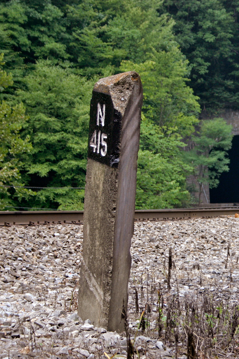
Standard Concrete Mile
Post
The standard N&W mile post was a three
sided, solid concrete fixture. Originally the
entire structure was left a natural finish with the
engraved letters painted black. In later
years a black band
was painted around the top portion and the letters
were painted white to add contrast and enhance
visibility. The posts were 7'-6" long and
weighed a substantial amount. Standard
placement was between 7' and 12' from the nearest
rail.
Every N&W line used an alphanumeric prefix such as
"N415" as seen on this milepost located between Roderfield and Iaeger, West Virginia. The "N"
designates that this location is 415 miles from
Norfolk. Another example would be the main
line between Hagerstown, MD and Ronaoke, VA.
Mileage along this route was measured from Hagerstown, thus each
milepost has an "H" prefix.
Secondary and branch lines were
also measured from their point of orgin as well.
Two examples are the Dry Fork Branch and the Spice
Creek Branch. The Dry Fork originates in
Iaeger, WV so the mileposts along this line are "I1"
to "I44". On the long abandoned Spice Creek
line which originated in Roderfield, the mileposts
were "R1" through "R4".
While there are still plenty of
authentic N&W mileposts in existence, many are being
replaced and/or supplemented by modern signs that
are much easier for crews to identify.
Photo by Jeff Hawkins
(August 5, 2007) |
|
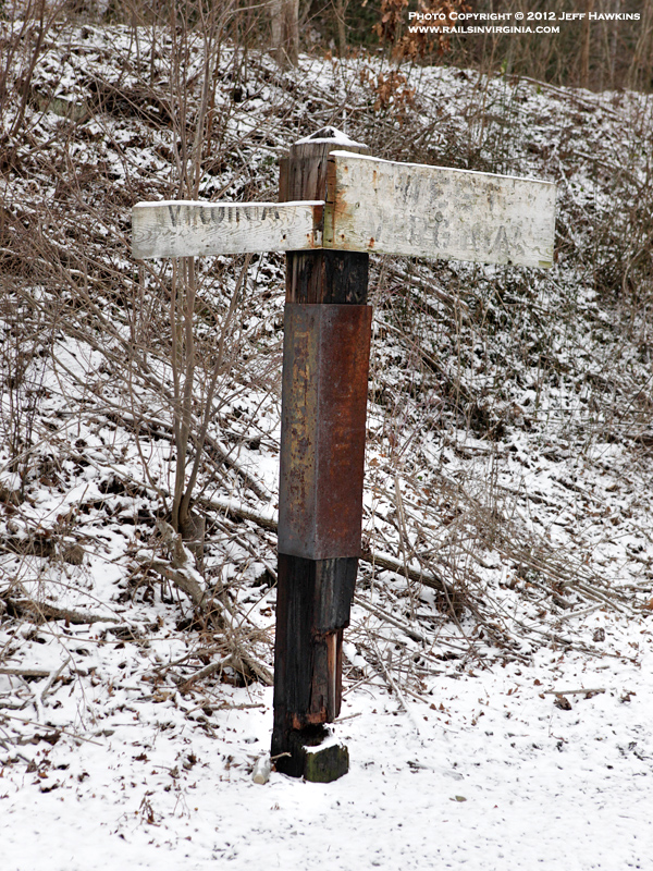
Standard State Line
Post
Beginning in 1909, the N&W installed
these markers where their tracks crossed a state
line. The two white
wooden signs at the top featured the state names.
Two posts were installed, one on each side of the
track 20' from the center of the gauge. In the photo above, "VIRGINIA"
and "WEST VIRGINIA" are barely
discernable. The
severely weathered metal signs about mid-height on
the post were marked with the name of the county. "TAZEWELL CO." and "MCDOWELL CO." at this
particular location. The marker pictured here
stands in Bishop, WV on the Jacobs Fork Branch, and is only one of
four known to still exist.
Photo by Jeff Hawkins
(December 30, 2012) |
|
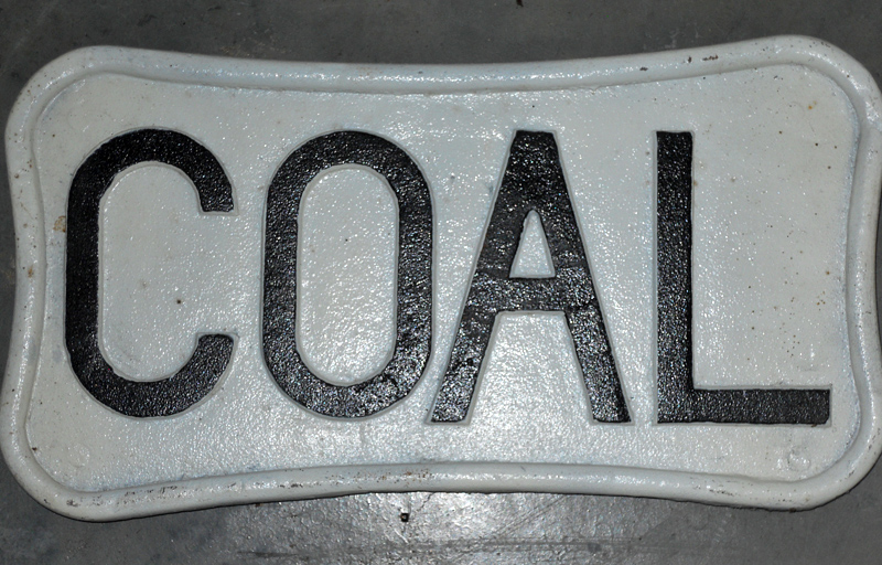
Coal 1 Mile Sign
This was placed one mile from and on
the right hand side of the track approaching a
mainline coaling station. The sign and post
weighed a combined 130 pounds and were placed
between 9' and 13' from the rail. The bottom
photo shows the later version that was introduced in
1948. This sign was bolted to a post via four
bolt holes drilled into the back of the sign.
Weight of the actual sign itself was 31 pounds.
Click
here to view a photo showing a coal sign in
advance of the coaling station at Vicker, Virginia.
The sign is visible in the bottom center of the
photograph. |
|
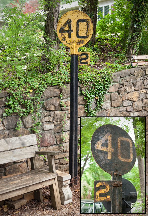
Speed Limit Sign
The N&W placed speed limit signs in
advance of curves where the speed was reduced from
the normal track speed.
These signs were made in the Roanoke Shops Foundry.
Some signs contained a single speed restrictions
while others had two sets of numbers with the bottom number
relevant to freights while the top number applied to
passenger trains. If the sign was applicable
to more than one
consecutive curve speed, there would be a small
square with the number of curves covered under the
speeds. The signs were painted yellow with black
lettering on one side and black
with white lettering on the other. An example
of a speed sign can be seen on the far right edge of
this
photograph.
|
|
Station 1 Mile Sign
This was placed one mile from the
outer switch(es) of any passing tracks, and one mile
from the semaphore signal at and on the right hand
side of the track approaching a
station.
|
|
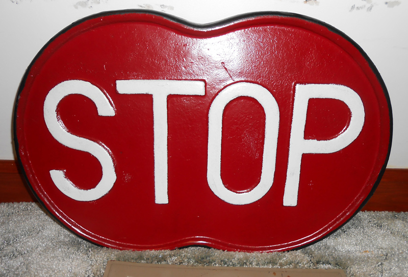
Stop Sign
The stop sign was placed
on the right hand side of the track
approaching non-interlocked railroad
crossings at grade. The sign was
to be located not less than 200' or more
than 800' from crossing. |
|
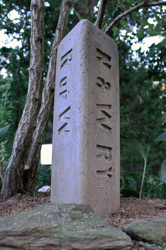
Right-Of-Way Monument
The N&W placed what they called
right-of-way monuments at all intersections of their
property lines. The monuments were set in a
manner so that the blank side was facing the
adjacent property owner. Made of Portland
Cement, the monuments were 4' tall, with only 1'-8"
protruding above ground level.
Photo by Kevin Simpson (January
2015) |
|
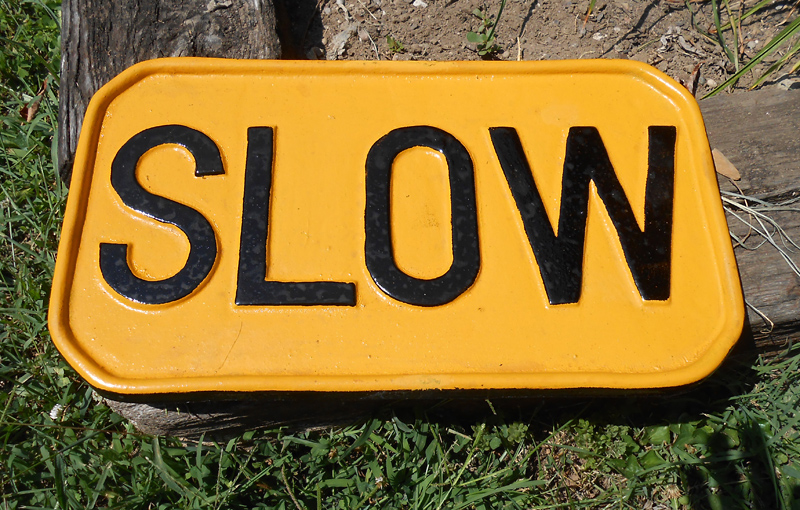
Slow Sign
This sign to be placed
one (1) mile from and on the right hand
side of track approaching points at
which speed is reduced by special
instructions. Measurements: 19"
wide x 11" tall |
|
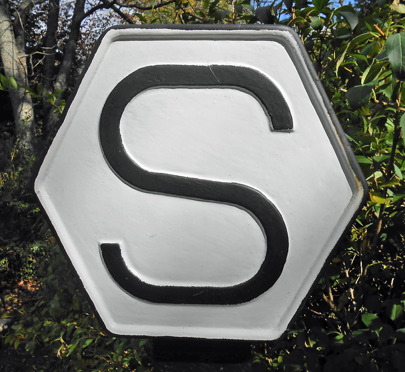
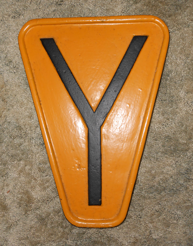
Sub-Division Sign
Measuring 20" wide and 9"
tall, these cast iron signs were placed
at the dividing line between sections on
the same side of the track as the
milepost. The numbers indicated
the section gang responsible for
maintaining the track. |
|
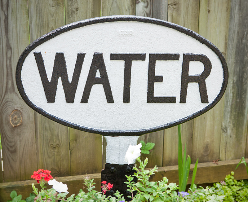
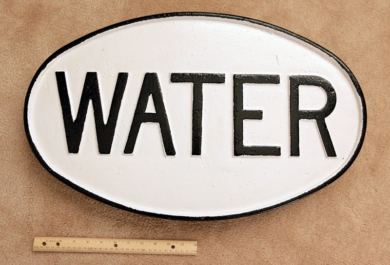
Water 1 Mile Sign
This was placed one mile from and on
the right hand side of the track approaching a
mainline water station. The original version
had a short post cast into the bottom of the sign.
It would then be bolted onto the main vertical post.
The sign and post weighed a combined 143 pounds and
were placed between 9' and 13' from the rail.
The bottom photo shows the later
version that was introduced in 1948. This sign
was bolted to a post via four bolt holes drilled
into the back of the sign. Weight of the
actual sign itself is 37 pounds.
Top Photo by Anonymous
Contributor (November 2013)
Bottom Photo by Jeff Hawkins
(November 2013) |
|
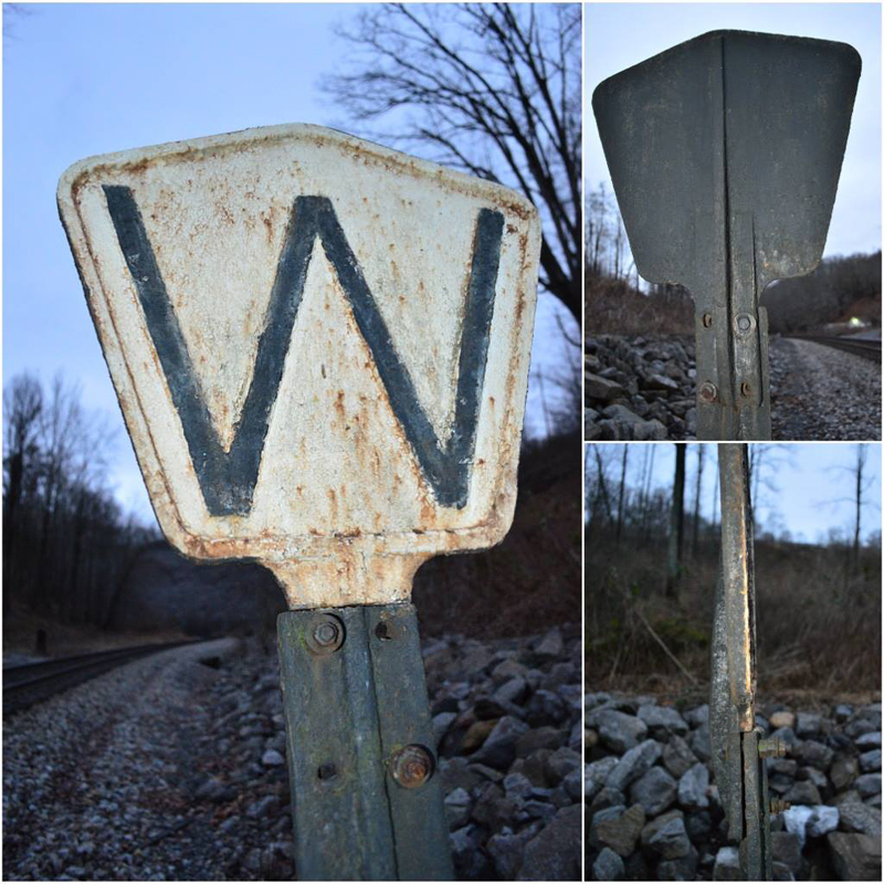
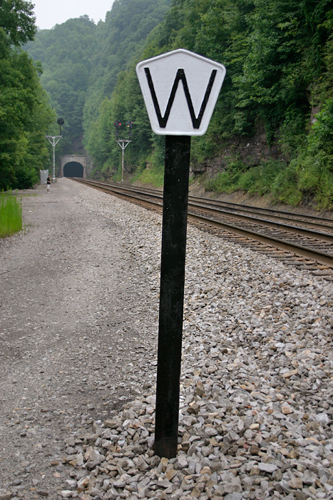
Whistle Post
The whistle post is one of the
most common signs found along railroads throughout
not only the United States, but the world.
Aside from instructing the engineer to sound an
audible warning at a grade crossing, they were also
located in advance of tunnels (as seen above) and
bridges. It was common for railroads to employ
their own unique style of whistle posts and the N&W
was no exception. Typically mounted on a
section of rail driven into the ballast, these
unique signs were painted white with a large black
"W". The letter W wasn't just painted on, but
rather forged into the material so it was a raised
surface, as were
the edges of the sign. What makes the N&W's
whistle posts unique is
that the "W" matches up with the design of the
pentagon shaped sign quite well. Fortunately
the N&W's whistle posts are still plentiful and can
still
be found throughout the system. The original
version had a short post cast into the bottom of the
sign as seen in the top photos. The newer
style whistle
post, which had the post bolt onto the back of the
sign, is pictured above near the west
portal of Twin Branch Tunnel #2 just east of Davy, West
Virginia with the "Marytown" signals visible
in the distance.
Top Photos by Tish
Adams (December 2013)
Bottom Photo by Jeff Hawkins
(August 5, 2007) |
|
Yard Limit Sign
Located at the yard limits on
the right side of the track.
|
|