|
Abandoned Rails
<
Pocahontas Branch Main Page
Photo Gallery: N&W
Pocahontas Branch
If you have
information or photographs that you'd like to share,
please
e-mail me.
|
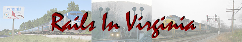
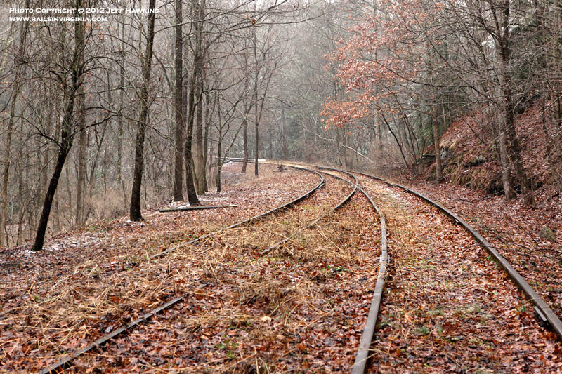
Bluestone Junction
Today the only visible trace of the
Pocahontas Branch at Bluestone are these rails
buried in the dirt. The mainline switch for
the branch was located approximately where the
orange construction barrel is seen in the distance.
Photo by Jeff Hawkins (May 25,
2012) |
|
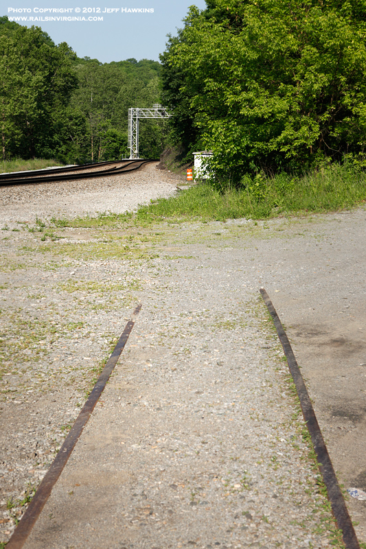
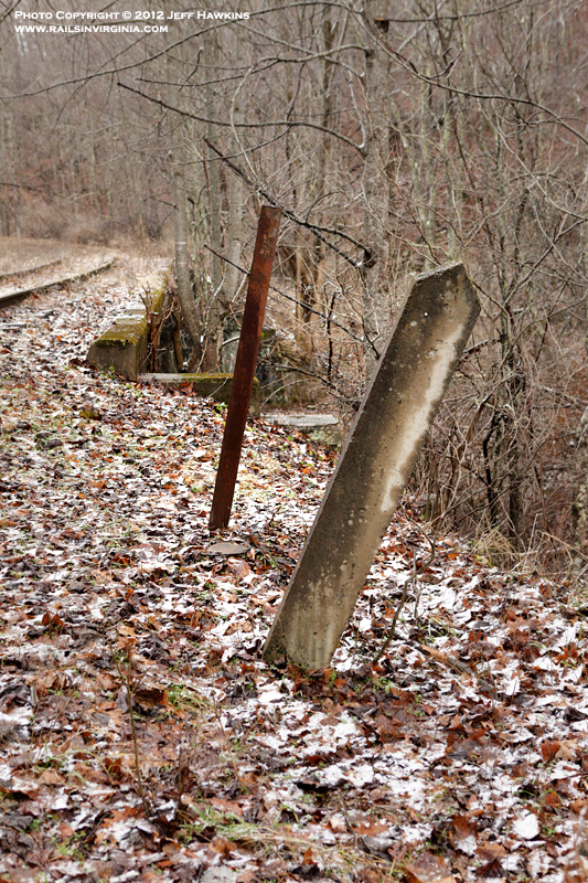
Bluestone Junction
Visible in several early 20th Century
photos of Bluestone is double blade semaphore that
was located in this general area. This
concrete base at Bluestone is presumed to have once
had a semaphore mounted on it.
Photo by Jeff Hawkins (May 25,
2012) |
|
Bluestone Junction
A short passing siding was located at
Bluestone Junction. It is believed to have
been used by passenger trains coming off the branch
and waiting to enter the mainline. This view
is looking south at the north end of the siding.
Although very hard to see, the switch is in the left
foreground under all the leaves and dirt.
Photo by Jeff Hawkins (December
29, 2012) |
|
Bluestone Junction
Looking east towards Bluestone
Junction with the Pocahontas Division mainline
visible in the distance. The mainline enters
Coopers Tunnel approximately 1,300' west of Bridge
851 which spans the Bluestone River as seen in this
photo. Just east of the tunnel portal is the
switch for the
Bluestone Branch.
Photo by Jeff Hawkins (December
29, 2012) |
|
Bluestone Junction
This view is from the same location
as the previous photo, but looking south towards
Pocahontas.
Photo by Jeff Hawkins (December
29, 2012) |
|
Bluestone Junction
Looking east towards Bluestone
Junction.
Photo by Jeff Hawkins (December
29, 2012) |
|
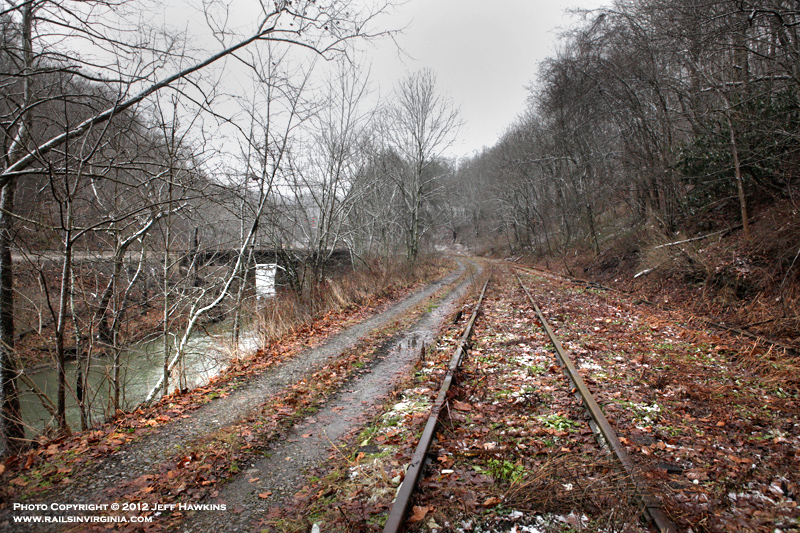
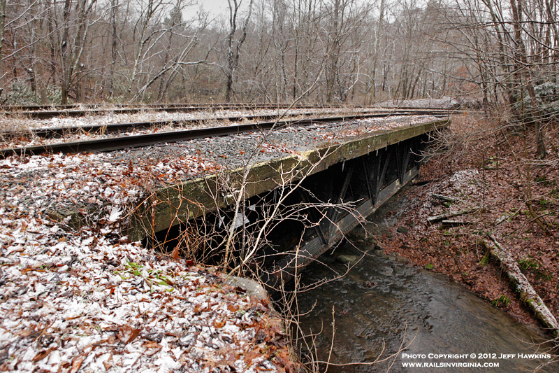
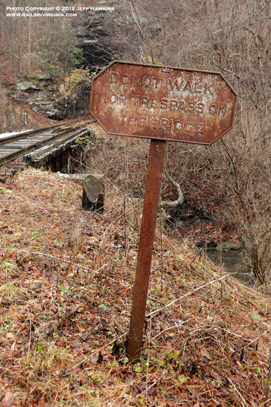
Bridge 852
Just around the curve from Bluestone
is the first bridge encountered along the Pocahontas
Branch. Bridge 852 is the first of several
structures that span Laurel Fork along the line.
This view is looking towards Pocahontas.
Photo by Jeff Hawkins (December
29, 2012) |
|
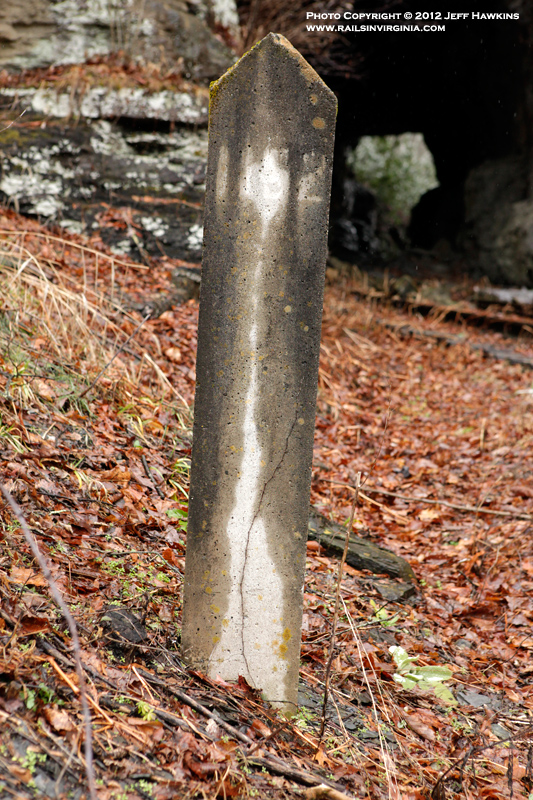
Bridge 852
Located on the north side of Bridge
852 is the original bridge identification marker.
One of the N&W's trademark "DO NOT WALK NOR TRESPASS
ON THE BRIDGE" signs was at one time mounted on the
metal post behind the bridge marker.
Photo by Jeff Hawkins (December
29, 2012) |
|
Bridge 852
A look at Bridge 852 from the side
showing the truss spans under the deck.
Photo by Jeff Hawkins (December
29, 2012) |
|
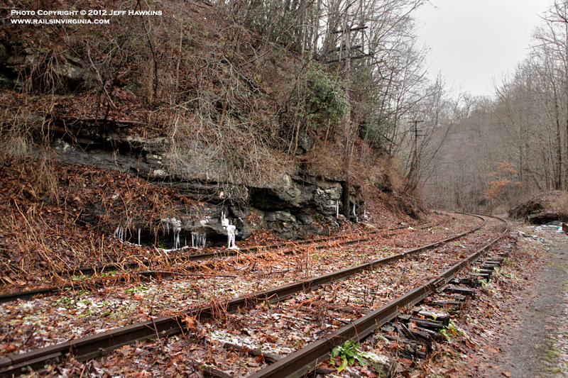
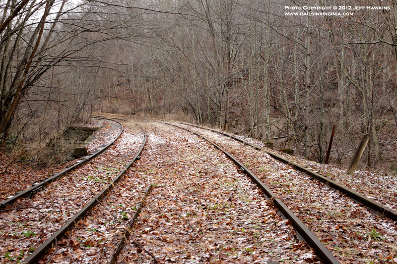
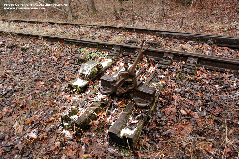
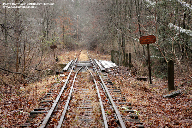
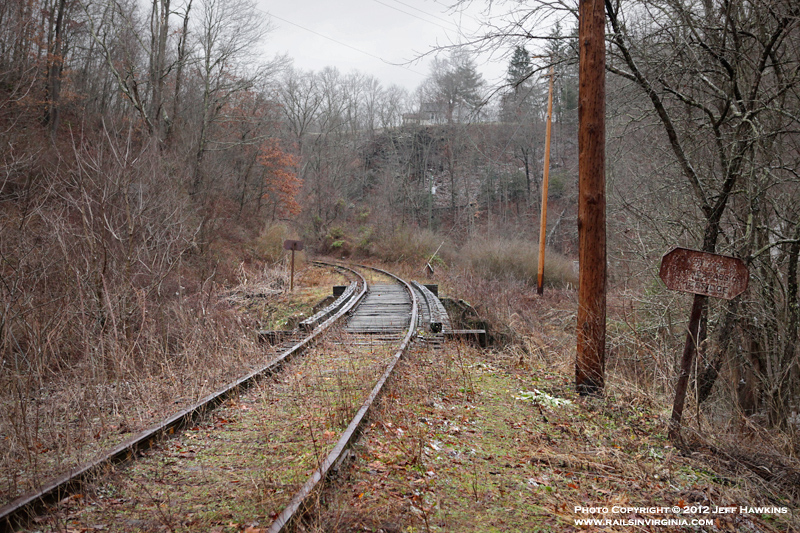
Bluestone Siding - South Switch
Looking south at the switch for the
south end of the passing siding is located just
north of Bridge 1151.
Photo by Jeff Hawkins (December
29, 2012) |
|
Bluestone Siding - South Switch
A close up view of the switch near
Bridge 1151.
Photo by Jeff Hawkins (December
29, 2012) |
|
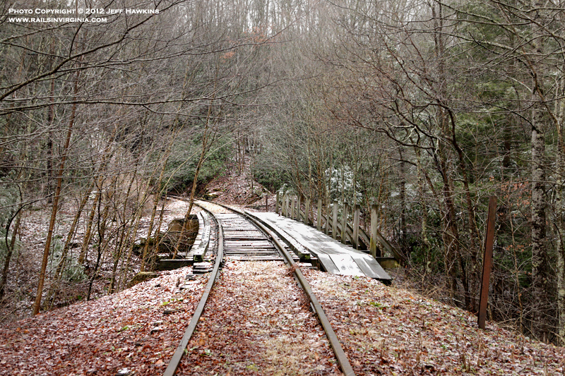
Bridge 1151
Located just north of Pocahontas
Tunnel No. 1 is Bridge 1151.
Photo by Jeff Hawkins (December
29, 2012) |
|
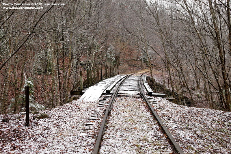
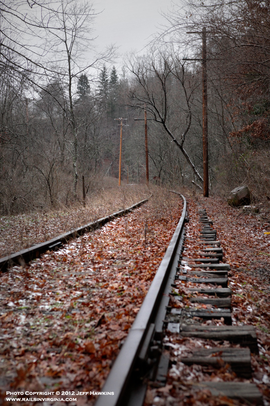
Bridge 1151
Looking north towards Bluestone at
Bridge 1151. As with Bridge 852, there were
metal poles on each side of the bridge where the no
trespassing signs were once located.
Photo by Jeff Hawkins (December
29, 2012) |
|
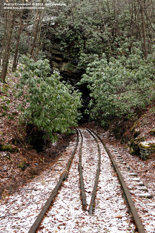
Pocahontas Tunnel No.
1
Peering into the rock cut leading to
Pocahontas Tunnel No. 1.
Photo by Jeff Hawkins (December
29, 2012) |
|
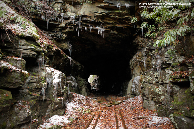
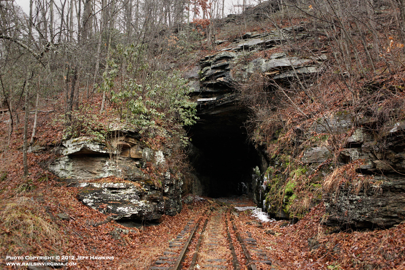
Pocahontas Tunnel No.
1
North portal of Pocahontas Tunnel No.
1.
Photo by Jeff Hawkins (December
29, 2012) |
|
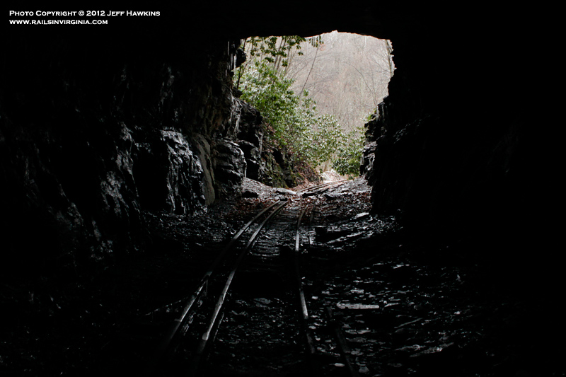
Pocahontas Tunnel No.
1
Looking out of the north portal of
Pocahontas Tunnel No. 1.
Photo by Jeff Hawkins (December
29, 2012) |
|
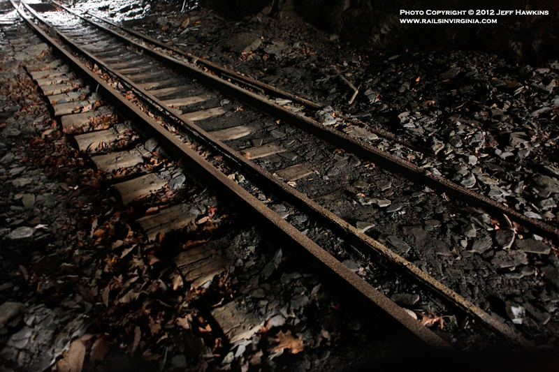
Pocahontas Tunnel No.
1
A look at the track inside the
tunnel.
Photo by Jeff Hawkins (December
29, 2012) |
|
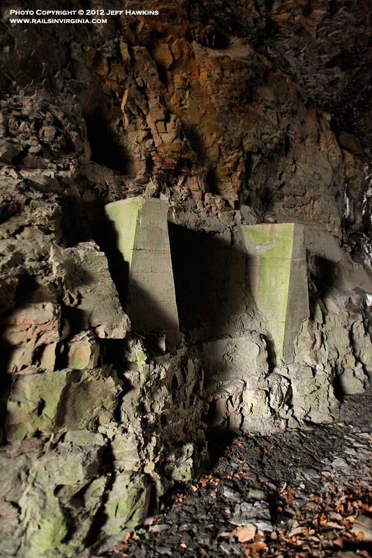
Pocahontas Tunnel No.
1
These concrete supports were believed
to have been installed to support the catenary
inside the tunnel. An identical set of support
were located on the opposite side of the tracks.
Photo by Jeff Hawkins (December
29, 2012) |
|
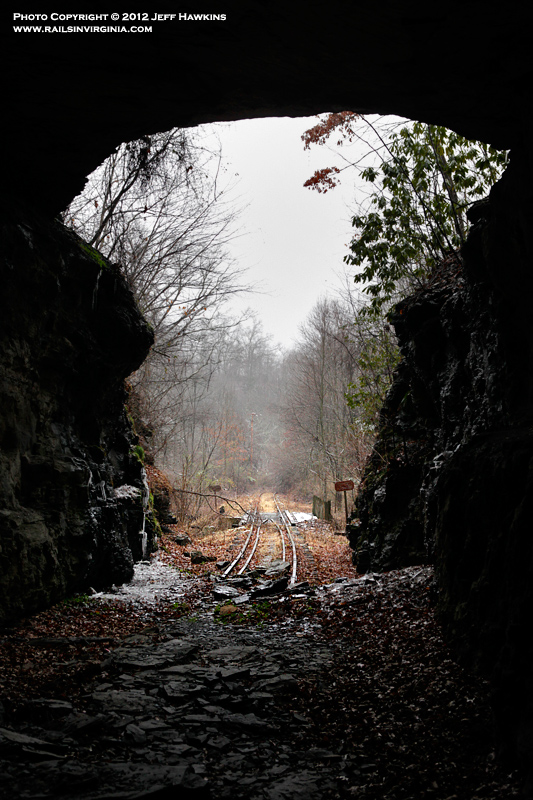
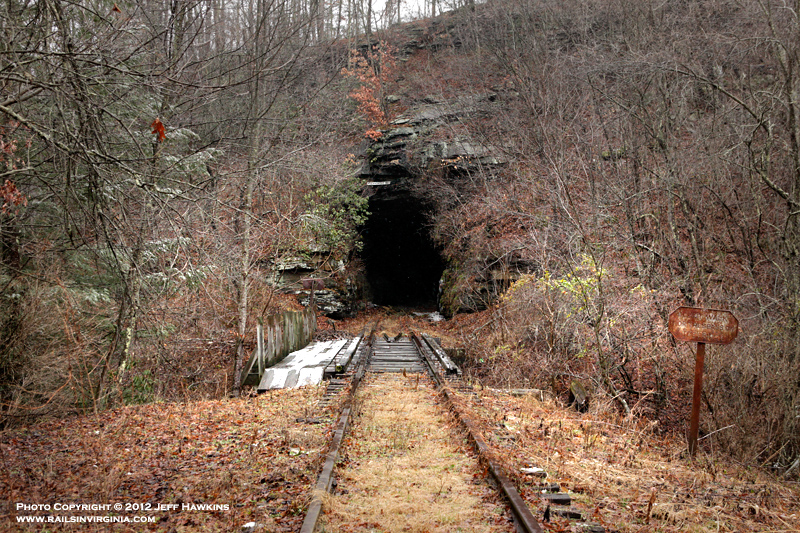
Pocahontas Tunnel No.
1
Looking out of the south portal of
Pocahontas Tunnel No. 1 towards Bridge 1152. Take
note of all the rock that has fallen on the tracks
over the years.
Photo by Jeff Hawkins (December
29, 2012) |
|
Pocahontas Tunnel No.
1
South portal of Pocahontas Tunnel No.
1.
Photo by Jeff Hawkins (December
29, 2012) |
|
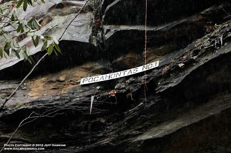
Pocahontas Tunnel No.
1
A detailed look at the tunnel
identification plate affixed above the south portal
of Pocahontas Tunnel No. 1. There is no sign
located at the north portal.
Photo by Jeff Hawkins (December
29, 2012) |
|
Bridge 1152
Bridge 1152 is one of two along the
branch that still retain much of it's N&W signage.
Do not trespass signs still stand on each end of the
bridge and the bridge identification maker is
visible on the left.
Photo by Jeff Hawkins (December
29, 2012) |
|
Bridge 1152
"1152" is still visible on the bridge
identification marker. These concrete posts
were originally painted black with white numbers.
Photo by Jeff Hawkins (December
29, 2012) |
|
Bridge 1152
Looking north at Bridge 1152 with the
south portal of Tunnel 1 in the background.
Photo by Jeff Hawkins (December
29, 2012) |
|
Bridge 1152
A close up view of one of
the N&W's distinctive no trespassing
signs that were positioned at bridges
throughout the system.
Photo by Jeff Hawkins (December
29, 2012) |
|
Wolfe
Looking south towards Pocahontas from
Bridge 1152.
Photo by Jeff Hawkins (December
29, 2012) |
|
Bridge 1153
Along with Bridge 1152, Bridge 1153
also retains both of it's cast iron no trespassing
signs.
Photo by Jeff Hawkins (December
29, 2012) |
|
Bridge 1153
Looking north across Bridge 1153
towards Bluestone.
Photo by Jeff Hawkins (December
29, 2012) |
|
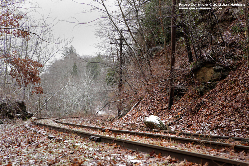
Wolfe
A low angle view of the track in
Wolfe.
Photo by Jeff Hawkins (December
29, 2012) |
|
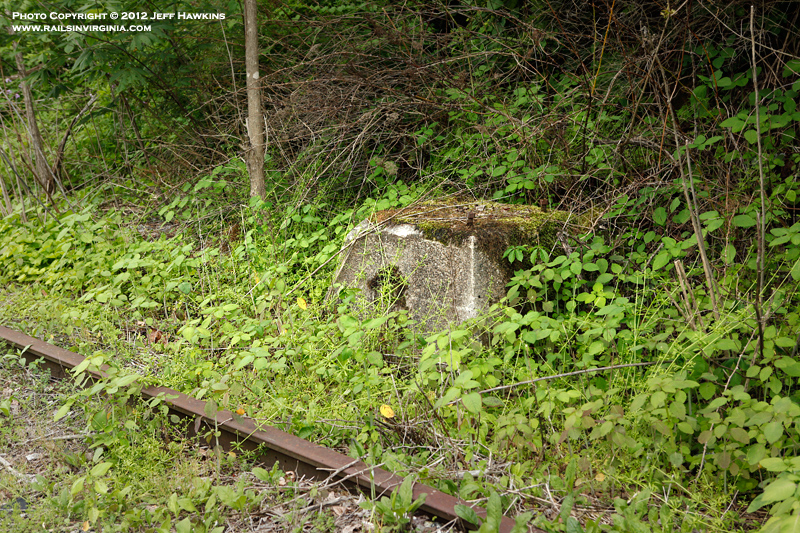
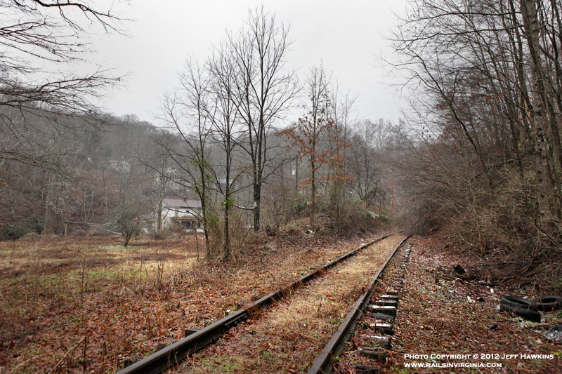
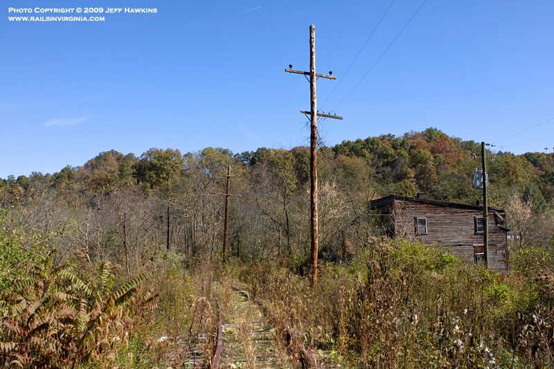
Wolfe
Wolfe, West Virginia is an
unincorporated town located on Route 102 between
Bluestone and Pocahontas. Originally the area
was known as Wolfe's Bottom. A post office was
operated here until it was closed in 2011.
Photo by Jeff Hawkins (October 19,
2009) |
|
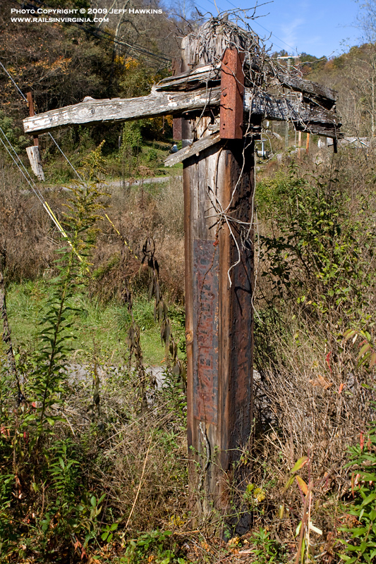
State Line Marker -
Wolfe
The N&W utilized a very unique type
of marker to identify where it's rails crossed a
state line. Just north of Pocahontas Tunnel
No. 2 the branch crossed from Virginia into West
Virginia. For a detailed explanation of these
makers, click
here and scroll to the bottom of the page.
Photo by Jeff Hawkins (October 19,
2009) |
|
State Line Marker -
Wolfe
A closer look at the metal plates on
which each county name was written on. In this
case "TAZEWELL CO." on the left side and "MERCER
CO." on the right. Unfortunately these
particular signs have been weathered to the point
where you can't make out the names anymore.
Photo by Jeff Hawkins (October 19,
2009) |
|
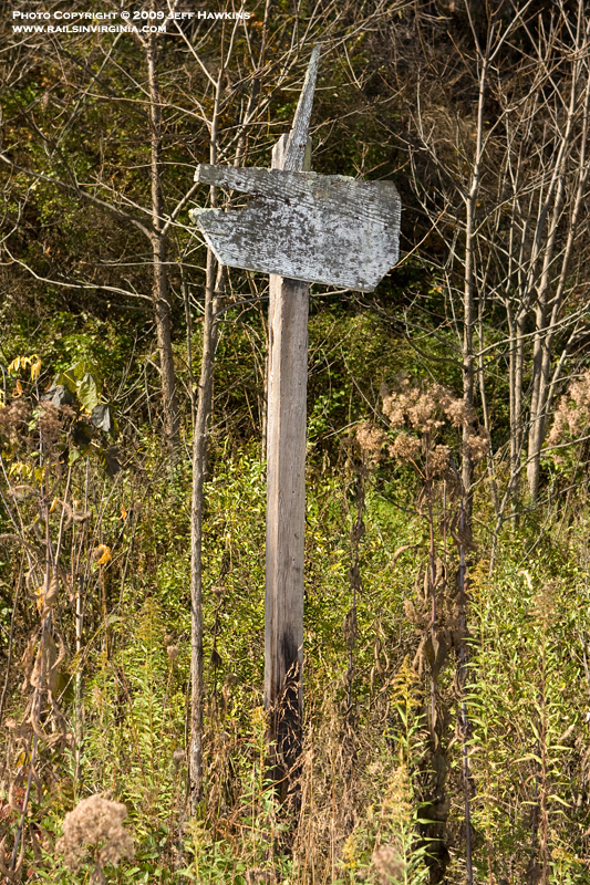
Unknown Sign - Wolfe
Positioned between the state line
marker and the tunnel portal was this wooden sign.
It is unknown exactly what it's purpose was.
Photo by Jeff Hawkins (October 19,
2009) |
|
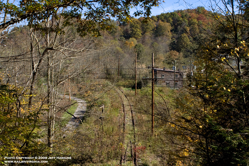
Wolfe
This photograph was taken from atop
Pocahontas Tunnel No. 2 looking towards Bluestone.
Route 102 passes directly above the tunnel and
offers an excellent view of the area. A keen
eye will detect the state line marker on the left
side of the tracks.
Photo by Jeff Hawkins (October 19,
2009) |
|
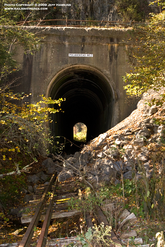
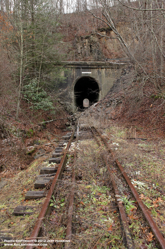
Pocahontas Tunnel No.
2
Originally a natural rock tunnel like
Tunnel No. 1, Pocahontas Tunnel No. 2 was lined with
concrete in 1915 as noted by the inscription above
the portal. Passing directly above the tunnel
is Highway 102 as noted by the raillings.
Photo by Jeff Hawkins (October 19,
2009) |
|
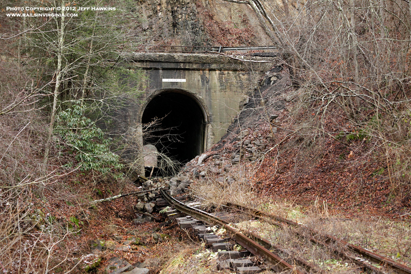
Pocahontas Tunnel No.
2
The two photos above show the north
portal of Tunnel 2 minus the foliage. It
appears that a combination of rock slides and water
drainage have taken a toll on the tracks and
roadbed.
Photos by Jeff Hawkins (December
29, 2012) |
|
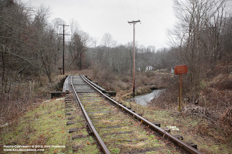
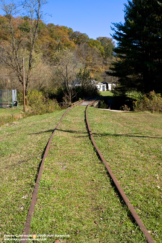
Pocahontas
The rails of the
Pocahontas Branch end at Route 102 on
the north side of Pocahontas. The
photographer is standing on the side of
Route 102 looking towards Bluestone.
Visible in the distance is Bridge 1154
over Laurel Fork. According to N&W
track charts this was once a double
track bridge and evidence of concrete
supports found here support this.
Photo by Jeff Hawkins (October 19,
2009) |
|
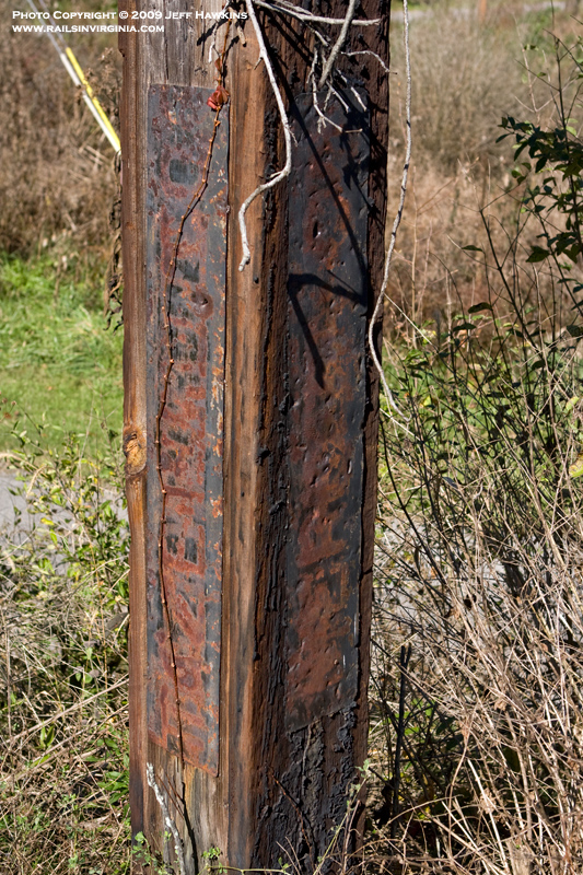
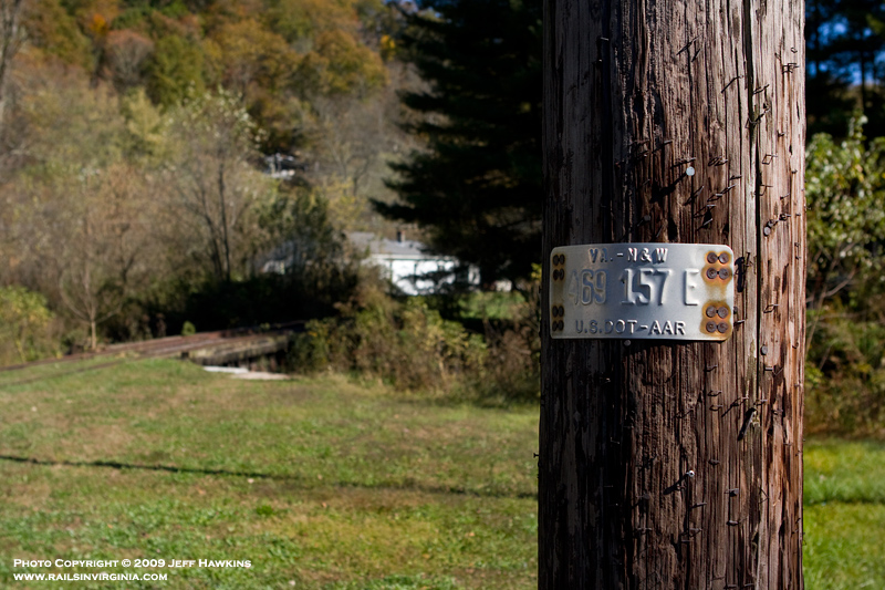
Pocahontas
This US DOT/FRA crossing
identification tag was still affixed to a pole at
the former Route 102 grade crossing in Pocahontas.
Photo by Jeff Hawkins (October 19,
2009) |
|
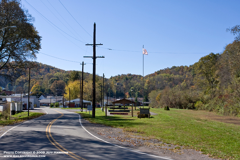
Pocahontas
In this view of Pocahontas, Virginia
we are looking south into town from where the
Pocahontas Branch crossed Route 102. The
grassy area in the right side of the photo was where
the yard was located. Approximately 700' away
in the center of the photograph is where the station
used to stand.
Photo by Jeff Hawkins (October 19,
2009) |
|