|
Abandoned Rails
<
Main Page
The N&W's Old
Mainline via Farmville
Burkeville to Pamplin
|
Farmville, Virginia
wasn't always destined to become a railroad town.
When initially surveyed by the South Side Railroad
in the 1840's, the company intended to utilize a
right of way that passed to the south of Farmville.
However a $100,000 offer by the community swayed the
railroad to lay their tracks through town.
This decision also resulted in the construction of a
large bridge over the Appomattox River east of
Farmville. Known as High Bridge, the structure
was considered one of the largest in the world when
completed in 1852. It stands 160' above the
river valley at it's highest point and measures
2,418' in length. High Bridge was the site of
the Battle of High Bridge during the Civil War and
suffered fire damage during the battle. The
South Side Railroad rebuilt it in 1869 after the war
ended.
In the decade following
the Civil War the South Side Railroad was merged
into the Atlantic, Mississippi, and Ohio Railroad
(AM&O). In the early 1880's', the AM&O fell on
financial hardship was purchased by the E.W. Clark &
Company of Philadelphia who renamed it the Norfolk &
Western Railway. In the early 1900's the N&W
constructed a second route to the south of
Farmville between
Burkeville and Pamplin. Often called the
"Farmville Beltline" or "low-grade" line, the
section from Pamplin to Abilene was completed in
1916.
During the years
following the N&W's acquisition of the Virginian
Railway in 1959, the old mainline began to play an
even more important role in the flow of rail traffic
between Tidewater and the coal fields. Because
the Virginian offered a much better route east of
Roanoke, all eastbound loaded coal trains were
routed over the ex-Virginian mainline to Abilene
where a new connection was installed with the N&W
beltline. The N&W's mainline east of
Burkeville was double-tracked all the way to Norfolk
and could easily handle the volume. The old
mainline hosted mostly westbound traffic which freed
up the beltline for eastbound moves.
Even into the final
years, a number of businesses along the line
continued to utilize rail service, however High
Bridge was beginning to become a maintenance concern
due to it's age. That coupled with the fact
that traffic volume, especially coal, had decreased
a considerable amount meant that the future of the
old mainline was in a precarious position.
The beginning of the end
came in 2003 when Norfolk Southern discontinued
through traffic over the old mainline with a local
out of Crewe continuing to serve customers.
Finally in March
2004 the dreaded announcement was made by Norfolk
Southern. It was going to formally abandon the
old mainline. A brief reprieve came during the spring and early summer months of
2004 as local railfans reported many trains,
including the circus train, operating over the old
mainline. Through trains continued to use the
old mainline sporadically until October 2004.
The last revenue movement
took place on Friday, July 15, 2005. NS
GP38-2 No. 5098 left Crewe Yard and traversed the line to
Farmville to retrieve the last few cars. There
were scores of people on hand to witness the event
including a number of local media outlets.
Removal of the track and signals began in late July
and was completed by early 2006.
Here is a list of the
last customers receiving rail service along the old
mainline:
-
Farmers Cooperative Feed Mill -
Downtown Farmville
-
Wilhoit Wood
Yard - Furnico
-
Steel supplier -
Furnico
-
Farmers Cooperative Fertilizer -
Furnico
-
Wood yard (seasonal) -
Prospect
-
Kyanite Mines - Pamplin
On June 28, 2007, Norfolk Southern
officially donated the right of way to the
Commonwealth of Virginia for a future rails to
trails project. Today the entire right
of way, less High Bridge, is part of High Bridge Trail State Park.
You can visit the park's official website at
http://www.dcr.virginia.gov/state_parks/hig.shtml.
The High Bridge segment is slated to open by the end
of 2011.
If you have
any material you'd like to contribute, please
contact me at
jl.hawkins@comcast.net.
|
|
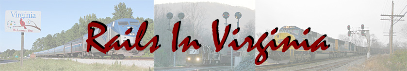
A lone color position light (CPL)
signal faces a grim future as it sits in the material storage yard
at Crewe. This was most likely the eastbound
signal for the mainline track at the Shields interlocking near Pamplin. The
CPL signals on the Old Main were replaced with Safetrans signals
throughout 1996 with the entire line being completed
in December of that year.
Photo by Jeff Hawkins (February
18, 2006) |
|
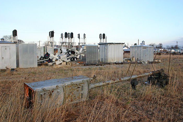
Visible signals include: 139.2, 141.1
(Rice), 144.2 (East High Bridge), 145.8 (West High
Bridge), 151.1 (Furnico), and 160.1 (Prospect).
The water tank dates from at least 1917 and had been recently repainted when this photo was taken.
It was once part of the roundhouse complex in Crewe
which was demolished in 1963.
Photo by Jeff Hawkins (February
18, 2006) |
|
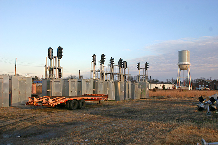
The former N154.1 signal. Note
the former N&W trailer behind the forklift. In
the distant right is the centerpiece of the Crewe
Railroad Museum, 2-8-0 #606.
Photo by Jeff Hawkins (February
18, 2006) |

|
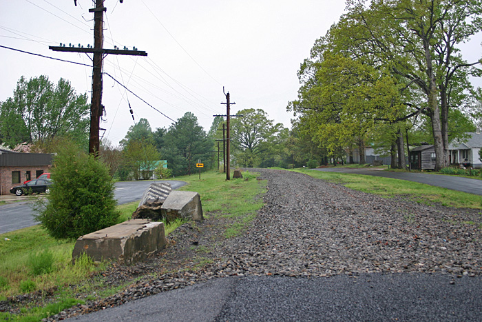
Atwood (N133.9)
The west end of the double track
leaving Burkeville heading west was called Atwood.
This view is looking east towards Burkeville near
the U.S. 360 overpass.
Photo by Jeff Hawkins (July 31,
2005) |
|
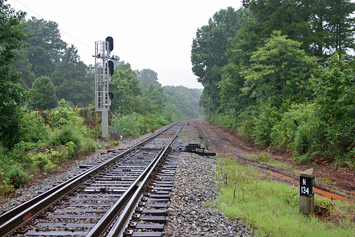
Atwood (N134)
Looking west from the N134 milepost
at the WAS (west absolute signal) at Atwood.
Photo by Jeff Hawkins (July 31,
2005) |
|
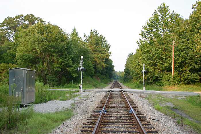
N138
Looking east from State Route 610
located at the N138 milepost.
Photo by Jeff Hawkins (August 2,
2005) |

|
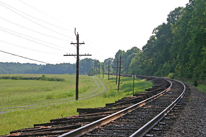
Rice (N141.7)
Looking west from the Orchard Road
grade crossing near the Nottoway/Prince Edward
County line.
Photo by Jeff Hawkins (July 31,
2005) |
|
Rice (N141.7)
We are in "downtown" Rice in this
view peering south along Rice's Depot Road where it
crossed the Old Main.
Photo by Jeff Hawkins (July 31,
2005) |
|
Rice (N141.7)
Looking west from Rice's Depot Road.
Photo by Jeff Hawkins (July 31,
2005) |
|
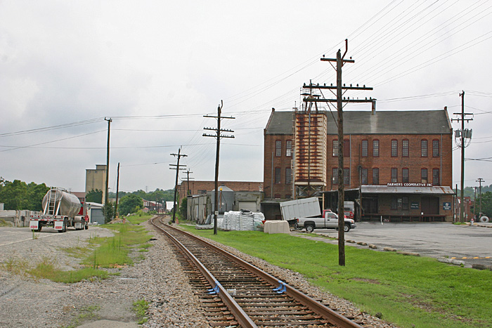
Farmville (N150.1)
Looking east from Appomattox Street.
Photo by Jeff Hawkins (July 31,
2005) |
|
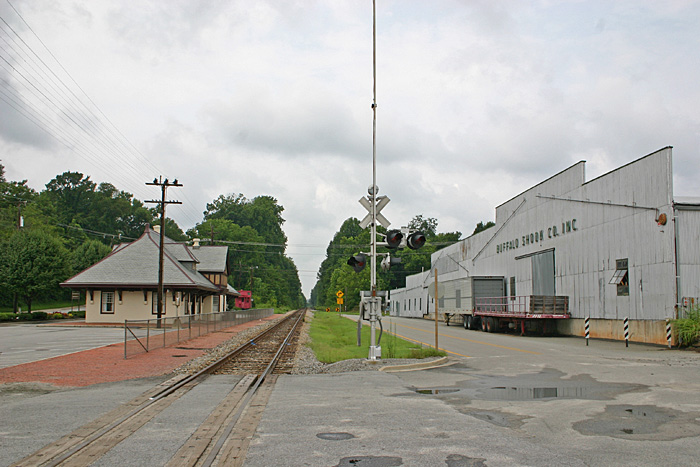
Farmville (N150.1)
Looking west from Appomattox Street
at the former N&W passenger station. During
the steam era there was a water tank were the
caboose is located. At one time there were
also two sidings located to the right of the
mainline. The station began serving the
traveling public on April 29, 1903. Amtrak's
Mountaineer traversed the line
from March 25, 1975 to
September 30, 1979.
Photo by Jeff Hawkins (July 31,
2005) |
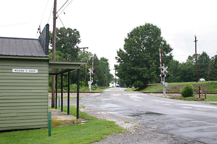
|
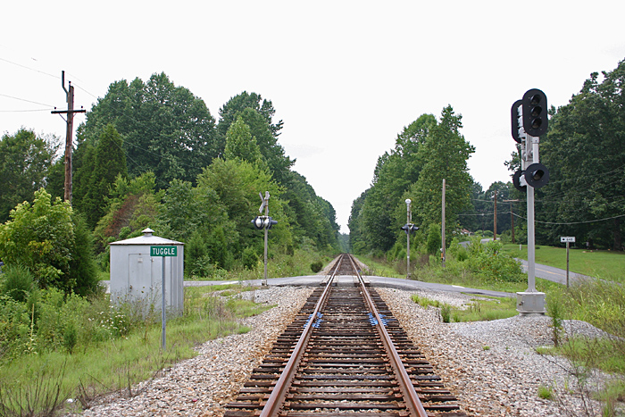
Tuggle (N156.4)
Looking west at the Hard Times Road
(SR 648) grade crossing.
Photo by Jeff Hawkins (July 31,
2005) |
|
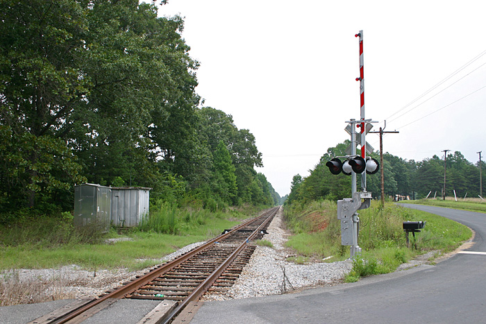
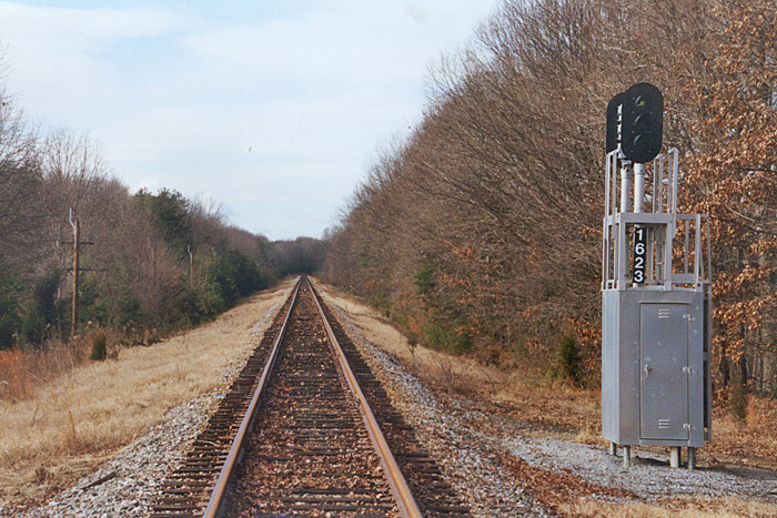
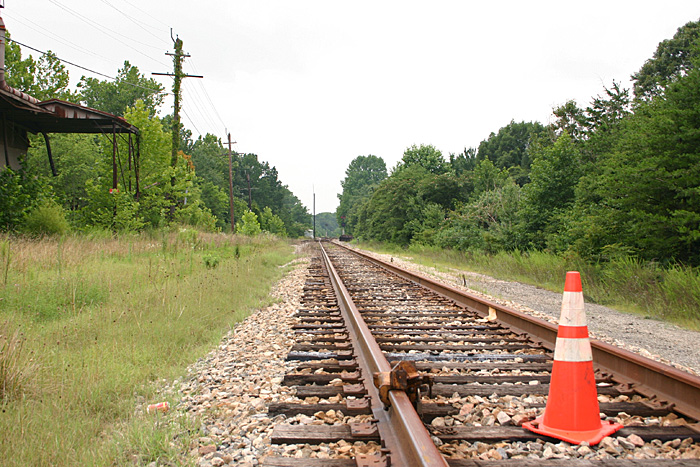
N158.4
Looking east from Oliver Road (State
Route 649) grade crossing. Just east of the
crossing is the N158.2 defect detector, one of two
that were in operation on the Old Main.
Photo by Jeff Hawkins (July 31,
2005) |
|
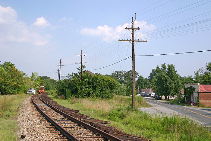
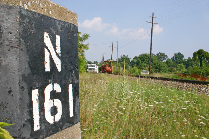
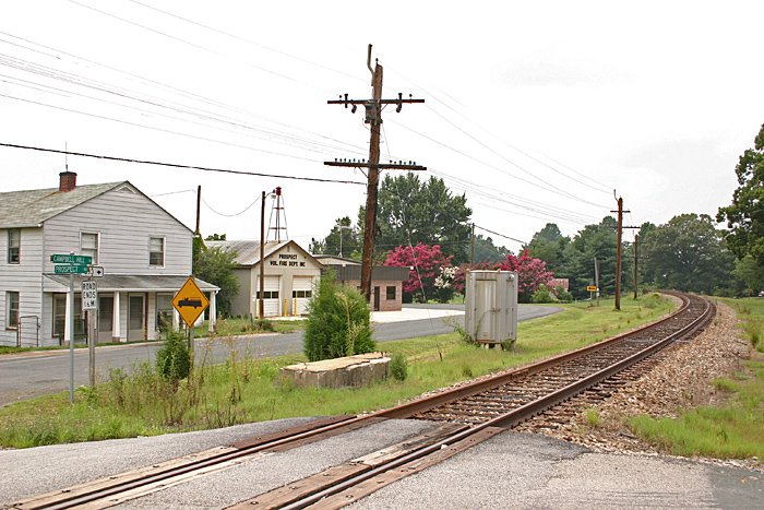
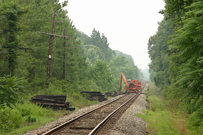
Prospect (N161)
Crews were working their way through
Prospect in August 2005. Every other tie was
being removed and placed to the side. The
former N&W depot is nearly hidden behind the
overgrowth in the center of the image with only the
roof barely visible.
Photo by Jeff Hawkins (August 2,
2005) |
|
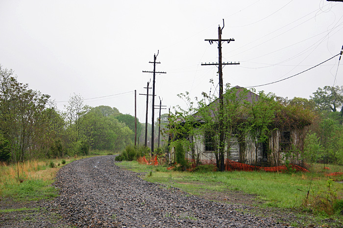
Prospect (N161)
Much of the brush seen in the
previous photo has been cleared affording a much
better view of the Prospect depot.
Unfortunately the station is in extremely poor
condition as a result of fire damage.
Photo by Jeff Hawkins (April 6,
2006) |

|
Prospect (N161)
Photo by Jeff Hawkins (August 2,
2005) |
|
Prospect (N161)
Photo by Jeff Hawkins (August 2,
2005) |
|
Prospect (N161)
Photo by Jeff Hawkins (July 31,
2005) |
|
Prospect (N161)
Photo by Jeff Hawkins (April 6,
2006) |
|
N161.3
I was quite impressed by how well
this land owner kept his property up along the
tracks. This scene was captured on the west
side of Prospect.
Photo by Jeff Hawkins (August 2,
2005) |
|
N162.3
Photo by Jeff Hawkins (December
20, 2003) |
|
N165
Maintenance of way crews are busy
removing ties in this view looking west from State
Route 751.
Photo by Jeff Hawkins (July 31,
2005) |
|
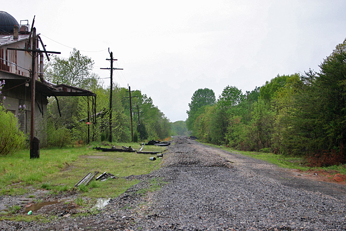
N167.9
The scene looking west from the State
Route 660 grade crossing near Pamplin.
Photo by Jeff Hawkins (July 31,
2005) |
|
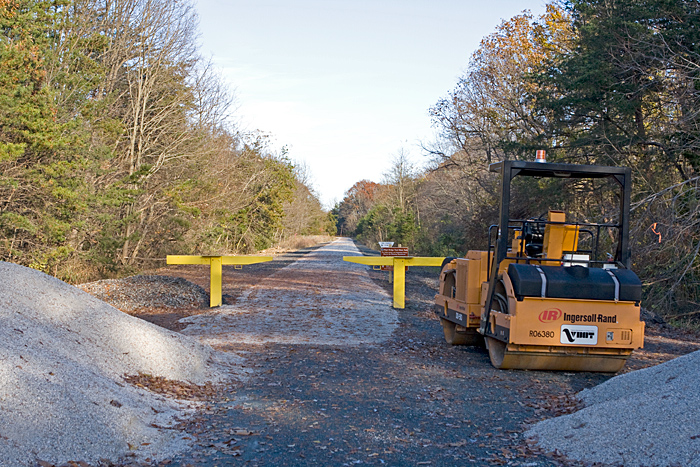
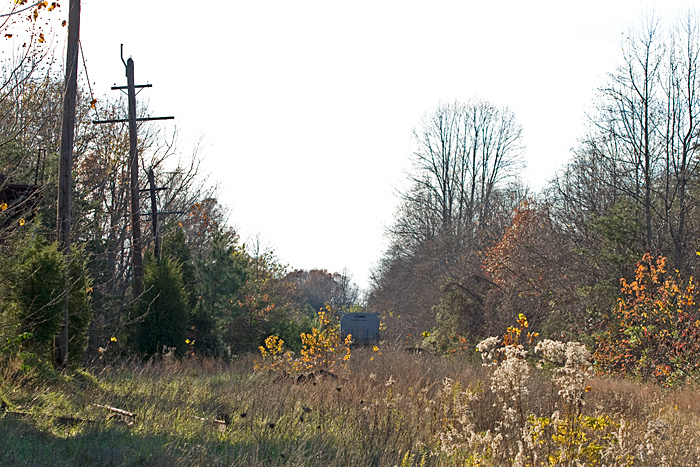
N167.9
Same location four years later.
This is now the western terminus of High Bridge
Trail.
Photo by Jeff Hawkins (November
15, 2009) |
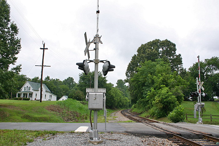
|
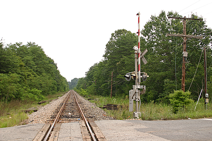
Shields (N168)
The power had not yet been cut to the
signal system as evidenced in this July 2005 photo
looking west at Shields. Shields was located
just east of Pamplin and marked the east end of
an 11,000' siding which stretched west to Bowler
(N170.6). The interlocking was located at the N168 milepost
which is visible in the bottom right corner of the
photo. I've often wondered why these CPL
signals were not retired in 1996 when the entire Old
Main was upgraded to Safetrans signals.
Photo by Jeff Hawkins (July 31,
2005) |
|
Shields (N168)
Photo by Jeff Hawkins (July 31,
2005) |
|
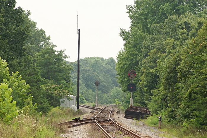
Shields (N168)
By April 2006 the scene at Shields
had changed dramatically. The tracks had been
removed and all that was left was ballast. The
signals in the previous photo were located
approximately 100 yards west of this location.
Photo by Jeff Hawkins (April 6,
2006) |
|
Shields (N168)
A third and final view looking west
towards what used to be the Shields interlocking.
This and the previous two photos were taken from the
State Route 660 grade crossing looking west. In the center
of the photo you can see the end of a string of
steel coil cars. This remaining segment of
track is often used for car storage.
Photo by Jeff Hawkins (November
14, 2009) |

|
N168.6
Just around the curve out of view is
Pamplin. The track to the left was the
mainline while the siding was on the right and is
still used for car storage.
Photo by Jeff Hawkins (November
14, 2009) |

|
Pamplin (N169.1)
What used to be the the mainline has
now been severed at Pamplin. The siding is
visible to the right while the Belt Line veers off to
the left between the signals and the depot.
Built in the 1920's, the former N&W station was
donated to the town in 1996 by Norfolk Southern.
It was converted into a branch of the Appomattox
County Library system and is known as the Pamplin
Depot Library.
Photo by Jeff Hawkins (November
14, 2009) |
|