|
Abandoned Rails
<
Main Page
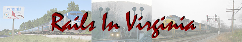
ACL Signals - The
A-Line
|
The Atlantic Coast Line
Railroad installed automatic block signals (ABS) on their double track
mainline between Richmond, VA and Rocky Mount, NC in
the late 1940's. This resulted in the
replacement of semaphores with the ACL's
classic searchlight style signals that were
manufactured by Union Switch & Signal. These
installations remained in place
until the late 1980's when CSX decided to single
track most of the North End Subdivision leaving only
fragments of the second main in place as either
passing sidings or long stretches of double track.
Crews began working on the project at Reams, near
Petersburg, and progressed southward to Rocky Mount.
Fortunately the entire double track mainline between
Petersburg and Richmond was left intact.
As a result of the downgrade, most of the ACL's
vintage searchlight signals were removed from
service.
On average the ACL
installed intermediate signals approximately every
two miles along the entire route between Richmond
and Rocky Mount. The line was setup for
single direction ABS with the current of traffic
operating on the right hand track. This meant
that the southbound signals were only
installed for the southbound main and vice versa.
When CSX removed the double track, they installed
bi-directional signals and upgraded the line to
centralized traffic control (CTC).
Thanks to many generous
contributions, we are able to take a look back at
many of these signal installations. If you have
any information or photographs that you'd like to contribute, please
contact me at
jl.hawkins@comcast.net.
|

|
Chester, VA (A12.6)
The last set of ACL signals in Virginia were
located just south of Richmond in Chester.
Here we see Amtrak 79 splitting the searchlights which
were replaced in late summer 2005. The area to
the left of the train has been developed into a
retirement community.
Photo by Jeff Hawkins
(November 6, 2004) |

|
Appomattox River (A23.3)
This southbound SCL manifest is
coming off the Appomattox River Bridge in Petersburg
just two years after the ACL-SAL merger. The
lead engine is on the bridge spanning the former SAL
mainline just west of Commerce Street Station. To
the right of the engine is the signal guarding the
interlocking where the line goes to single track at
the river.
Photo by Walt Gay
(August 1969) |

|
BX Tower (A25.5)
A northbound extra is pulling it's
train out of the yard lead at BX Tower which is just
out of view behind the locomotives. The signal
protected a set of crossovers that were located
here.
Photo by Walt Gay
(August 1969) |


|
Collier Yard (A27.0)
This intermediate signal was located
at Collier Yard at the 27 milepost. The top
photo is looking north sometime in the 1950's.
Note the coaling tower visible in the distance
behind the signal. In the image above, a
northbound SCL train passes Collier Yard on it's way
to Richmond.
Top: Photo by J.I. Kelly - Old
Dominion Chapter NRHS Collection
(Date Unknown)
Bottom: Photo by Walt Gay (July 7,
1969) |


|
Rowanty Swamp (A39.2/39.3)
Situated just over two miles south of
Carson, Virginia were these intermediate signals.
The 39.2 signal has an additional signal head added
due to the fact that the double track was in the
process of being removed. This additional
aspect allowed the 39.2 signal to temporarily serve
as the distant signal to the north end of double
track at the Carson interlocking, just over a mile
north of here.
Photos by Vernon Hobbs
(Circa late 1980's) |

|
Stony Creek, VA (A43.4)
Vernon Hobbs was in position to
capture CSX signal crews removing the A43.4
intermediate signal.
Photos by Vernon Hobbs
(Circa late 1980's) |


|
Stony Creek, VA (A43.5)
Vernon Hobbs, a long-time resident of
Stony Creek, captured the above sequence of photos
throughout the 1980's of the 43.5 intermediate
signal in downtown Stony Creek.
Photos by Vernon Hobbs
(Circa late 1980's) |

|
Jarratt, VA (A53.2)
Situated 53 miles south of Richmond
is the Town of Jarratt where the ACL and the
Virginian Railway's Norfolk to Roanoke mainline
crossed at grade. The diamond was removed just
a few years before this photo was taken when the N&W
abandoned the former Virginian between Algren and
Abilene in 1986. The brick structure to the
left of the mainline was the Virginian's station in
Jarratt. It was built in the mid-1950's to
replace the previous station which was destroyed by
fire. The southbound signal can be seen on the
opposite side of the tracks just a bit to the north.
When originally installed, these signals had two
heads, both offset to the left side of the pole and
would have protected the diamond. As with the
39.2 signal, the lower aspect on the northbound
signal seen in this photo was added during the
single tracking project which was in full swing at
the time this photo was taken. As a result,
the double track now ends two miles north of Jarratt
at the A51 milepost. The siding in the
immediate foreground was the house track for the
ACL's passenger station in Jarratt.
Photo by Vernon Hobbs
(Circa late 1980's) |

|
Emporia, VA (A62.6)
In downtown Emporia the ACL
encountered another crossing at grade with a
railroad. Here it was the Norfolk, Franklin,
and Danville Railroad as seen in this view looking
north from the E. Atlantic Avenue grade crossing.
The diamond is visible in the distance adjacent to
the interlocking tower. The southbound main
(to the left) is now the single-track mainline
through town. Also note the northbound signal
is lined clear for a northbound movement.
Today the diamond sees train of CSX and Norfolk
Southern cross here while the tower has been
demolished. To see another view of the tower,
diamond, and signal, click
here.
Photo by Vernon Hobbs
(Circa late 1980's) |

|
Trego, VA (A66.6)
The infamous "666" signal just north
of Trego.
Photo by Vernon Hobbs
(Circa late 1980's) |

|
Garysburg, NC (A79.9)
A side profile of the southbound
signal for #1 track at Garysburg.
Photo by Vernon Hobbs
(Circa late 1980's) |

|
Garysburg, NC (A80.0)
Looking north at the Garysburg crossovers. This
interlocking was located just north of the Oak
Street grade crossing in Garysburg and was removed
when the line was single tracked. Today's
Garysburg interlocking is located just over a mile
north of this location and is the north end of the
double track between Garysburg and North Weldon.
Photo by Vernon Hobbs
(Circa late 1980's) |

|
Weldon, NC (A83.6)
Just south of the Roanoke River
Bridge in Weldon was an interlocking tower of
similar design to those at FA and Emporia (BX was of
different architecture). The speeder was used
by the lead signal maintainer who also happened to
be the mayor of Weldon.
Photo by John Jones -
Bobby Hamill Collection
(Circa 1979) |

|
YD (A123.2)
At the south end of Rocky Mount Yard
was the interlocking of YD. To the best of my
knowledge and that of other ACL experts, YD was the
telegraph code for Yard. In addition to a
pair of mainline crossovers, YD also controlled two
switching leads that joined into the northbound main
track. Each set of mainline signals were
located on signal bridges while the signals for the switching leads
were mounted on poles with three
searchlight heads a piece. All the signals at
YD were replaced in mid-August 2012.
Photo by Jeff Hawkins (October
8, 2005) |

|
Elm City (A128.2)
While not physically located in the
Town of Elm City, this signal bridge was always
referred to as such by train crews. This
installation stood one mile north of town
approximately 200' north of the US 301 overpass.
Note how the signal heads are mounted below the
bottom horizontal beam to allow approaching trains
to see the aspects below the highway bridge on which
the photographer is standing. When this
structure was erected in the 1940's, the overpass
didn't exist. It was constructed years later
in conjunction with the realignment of US 301 to
bypass downtown Elm City. Prior to the new
road being built, there was a grade crossing just
beyond the signal bridge approximately where the
defect detector is seen in the distance.
Ultimately CSX replaced this installation in 2007
with a pair of bi-directional Safetrans pole
signals.
Photo by Jeff Hawkins
(September 13, 2002) |

|
South Elm City (A130.5)
Just over a mile south of Elm City
was the interlocking of South Elm City which
consisted of a pair of crossovers, a configuration
that dates back to the late 1940's. The
northbound signal bridge (seen above) was removed
from service in mid-August 2012. There used
to be another signal bridge at the opposite end of
the interlocking on which the southbound signals
were mounted.
That structure was the casualty of a derailment in the late 1980's and
was replaced with pole
signals with searchlight heads which still stand.
Photo by Jeff Hawkins
(April 13, 2012) |


|
Wilson-NS (A136.5)
The purpose of the signals at the
Wilson-NS interlocking were to protect the diamond
where the ACL crossed the Norfolk Southern Railway
at grade. When the ACL signals fell on August
12, 2003, the northbound signal bridge was not
replaced. Instead the new northbound signals
at South Wilson will now control northbound
movements across the diamond as the two
interlockings have been combined into one. The
cantilever signal bridge was replaced by a pair of
pole signals. It should also be noted that the
cantilever signal bridge itself a replacement.
When the ACL originally installed searchlight
signals through here in the 1940's, the southbound
signals were mounted on a signal bridge.
Photo by Jeff Hawkins
(April 26, 2013) (April 16, 2005) |


|
South Wilson (A137.1)
The signals governing movement at
South Wilson were strictly northbound in
orientation. The aspects on the old signal
bridge applied to the No. 1 mainline track and the
yard lead. A separate pole signal for the No.
2 mainline was located on the north side of the US
301 overpass. The signal bridge was replaced
by a cantilever signal that controls both mainline
tracks. The ACL signals at South Wilson were
removed from service on August 12, 2013 and all of
the new signals have been incorporated into the
newly created Wilson interlocking, designated as
A136.9.
Both photos by Jeff Hawkins
(April 26, 2013) |


|
Contentnea (A139.0)
Named for Contentnea Creek which
passes under the mainline between the signal
bridges, Contentnea was one of the most photographed
locations on the South End Subdivision.
Between 1885 and 1892 the Wilmington & Weldon
Railroad constructed the
Fayetteville Cutoff between Wilson, NC and Pee Dee,
SC. Contentnea was the northern junction of
the cutoff and the original mainline to Wilmington,
NC. The Fayetteville Cutoff was constructed in
three phases: Contentnea to Fayetteville
(1885-1886), Pee Dee, SC to Rowland, NC (1886-1888)
and Fayetteville to Rowland (1892). Today the
cutoff route is CSX's mainline between Rocky Mount,
NC and Florence, SC.
The old mainline remains
active with the tracks in place as far south as
Wallace, NC. The line between Contentnea and
Wallace is known as the CSX W&W Subdivision, a nod
to the railroad that constructed the line in 1840, the
Wilmington & Weldon Railroad. When
completed, the W&W was the longest railroad in the
world at 161.5 miles in length. The W&W was
merged into the Atlantic Coast Line Railroad on
April 21, 1900.
Both signals bridges were removed
from service on August 12, 2013. The pole
signal that governed northbound movements off the
W&W Subdivision was also replaced. In fact,
the aspects for the W&W Sub along with both mainline
tracks have all been incorporated into the new
northbound cantilever signal bridge. During the steam
era a pair of water tanks were located on the east
side of the mainline just north of Contentnea Creek.
It should be noted that Contentnea,
along with the other signal bridges between here and
Rocky Mount, retained their smoke shields until the
very end. The shields are the large panels
mounted beneath the structure above each track.
Photo by Jeff Hawkins
(Top photo - April 27, 2013, middle and
bottom photos - April 13, 2012) |


|
South Contentnea (A141.0)
In 1961 the ACL began
removing sections of double track between Rocky
Mount, NC and Savannah, GA. The first segment to be lifted was a
nearly six mile stretch south of Wilson. The
new interlocking at the north end of the single track
was located at milepost 141 and was named South Contentnea.
September 22, 2013 marked the end of service for the
ACL signals here.
Both photos by Jeff Hawkins
(July 5, 2003) |

|
Kirby Hill (A148.8/148.9)
The area where NC 581 crosses the
former ACL mainline several miles north of Kenly has
been known as both Boyette and Kirby's Crossing
dating back to the early 20th Century. Both
names are derived from prominent local families.
There was once a small town built around the
railroad crossing that was named Boyette. It
is interesting to note that the area was spelled Boyette in
ACL track charts and labeled as Boyett on
topographical maps for many decades. During the early
1900's Mr. Ranson Pitts Kirby owned and operated a
lumber mill and cotton gin here. A small
siding was once located on the west side of the
mainline to accommodate the local businesses.
It is unknown whether a passenger and/or freight
station was ever located here.
Prior to the double track being
removed in 1961 there were intermediate
signals located a half mile to the north and
south of the crossing. It was at this time the
signal bridge was erected to govern traffic
over the reconfigured double track between Aycock
and Kenly. Aycock was named for Mr.
Charles Aycock, the former North Carolina Governor
(1901-05) who was born in nearby Fremont. The
new signal installation was named Kirby Hill in
homage of the aforementioned Kirby family. The hill
aspect of the name comes from
the fact that a half mile north of the signal bridge
is the crest of a long grade for trains in both
directions. The climb to Kirby Hill for both
north and southbound trains is approximately four
miles long.
Photo by Jeff Hawkins
(April 13, 2012) |

|
Kenly (A151.0)
Kenly is a small town located in
northern Johnston County and is named for John Reese
Kenly, an employee of the Wilmington & Weldon
Railroad. Mr. Kenly spent a great deal of time
in the area when the W&W was laying track through
Johnston County in 1886. Because of his tenure
here, Mr. Kenly had become a well respected by the
locals. When the town was incorporated in
1887, the decision was made to name it Kenly in
honor of the man who helped bring prosperity to the
area. Today Kenly marks the south end of the
double track that extends northward to Aycock. The ACL signals were installed in
1961 and removed from service on
September 22, 2013. The photo above shows
Kenly prior to the removal of the code line poles.
Today the trees along the east side of the mainline
have grown taller than the signal bridge. Note
the signal bridge at Kirby Hill visible at the top
of the grade over two miles away.
Photo by Jeff Hawkins
(July 5, 2003) |

|
South Micro (A157.9)
South Micro is the north end of a six
and a half mile stretch of double track that extends
south to North Smithfield (A164.4). The
northbound signal bridge and southbound pole signal
were replaced on January 20, 2014.
Top photo by Jeff Hawkins
(April 28, 2013)
Bottom photo by Jeff Hawkins (July 5,
2003) |

|
North Selma (A160.0)
The North Selma interlocking was
created in 1961 when the ACL was removing sections
of double track and reconfiguring existing sections.
North Selma fell under the latter when double
crossovers were installed here. The crossovers
are utilized extensively Amtrak trains 79 and 80.
Both signals bridges fell on January 20, 2014.
Photo by Jeff Hawkins
(April 16, 2005) |


|
Selma & Selma Connection (A160.9)
There are two separate interlockings
at Selma where the ACL crossed the Southern Railway
at grade. Just north of the passenger station
is Selma Connection which facilitates the movement
of four Amtrak trains daily between CSX and Norfolk
Southern rails. Trains 79, 80, 91 and 92 only
operate west to Raleigh and north to Richmond from
Selma, which itself is a schedule stop for all of
the aforementioned trains. Amtrak service to
Selma was established on October 31, 1982 when the
Palmetto began calling here. On the CSX side
of the connection a trio of SCL tri-light signals
governed train movement until being replaced by
Safetrans hardware on January 20, 2014.
Visible in the bottom photo is the
northbound cantilever signal bridge that stood until
it was replaced sometime between February and July
2008. The southbound signals were replaced in
1999 by the Safetrans cantilever signal bridge seen
in the above photo. Prior to that the
southbound signal configuration was comprised of a
single track cantilever signal for Track 2 and a
unique cantilever signal for Track 1 that was
mounted atop the station platform. Click
here for a photo. This same structure had
semaphores mounted on it prior to the searchlight
signals being installed in the late 1940's.
It should be noted that the passenger
station was built in 1924 as a joint construction
project by the Atlantic Coast Line and Southern.
The building was placed on the National Register of
Historic Places on June 24, 1982. In 2002 a
$3.2-million renovation was completed on the
structure. To see a 2001 view of the station
and general area prior to the renovation, click
here.
The white building seen in the left
side of the top photo is the Atlantic Coast Line
freight station. I do not know it's exact
build date, however I have seen a photo of it from
the 1930's.
Top photo by Jeff Hawkins
(April 14, 2012)
Bottom photo by Jeff Hawkins (April
16, 2005) |
|
North Smithfield (A164.4) - South
Godwin (A194.6)
Signals between and
including North Smithfield and South
Godwin were deactivated on Monday, June
9, 2014. The signal suspension
began at 0800 hours. Included Four
Oaks, South Four Oaks, Alaska, North
Dunn, South Dunn and Kay.
|
|